Adi Kailash Yatra Route Map & Pilgrimage Guide
You have been dreaming about it. A sacred Himalayan peak that mirrors Mount Kailash in Tibet — yet
far less crowded, equally powerful, and fully accessible within India. The problem? Most travellers
struggle to find a clear, accurate Adi Kailash route map that actually tells them what to expect day by
day. Vague itineraries, confusing permit requirements, and missing altitude warnings leave pilgrims
frustrated before they even begin.
This guide solves all of that. You will find a complete, day-by-day Adi Kailash route map — from
Kathgodam railway station all the way to the sacred Jolingkong basin at 4,572 m — with every
sightseeing stop, driving distance, permit checkpoint, and spiritual landmark clearly explained. Whether
you are a first-time pilgrim, a seasoned Himalayan trekker, or a spiritual traveller searching for your next
soul-stirring journey, this is your definitive roadmap.
What Is Adi Kailash and Why Does the Route Map Matter?
Adi Kailash — also called Chhota Kailash or Baba Kailash — is a sacred Himalayan peak rising to 5,945
m in the Pithoragarh district of Uttarakhand, India. Ancient Hindu scriptures describe it as the earthly
abode of Lord Shiva, sharing the same divine energy as the great Mount Kailash in Tibet. Unlike its
Tibetan counterpart, Adi Kailash lies entirely within Indian territory and does not require a Chinese visa
— making it one of the most accessible Shiva pilgrimages on earth.The mountain also offers a rare bonus: a clear view of Om Parvat, a neighbouring peak where snowfall
naturally forms the sacred Sanskrit symbol 'Om' on the face of the mountain. Witnessing both Adi
Kailash and Om Parvat in a single journey makes this yatra spiritually unmatched.
Having a reliable Adi Kailash route map matters because the roads are remote, border checkposts
require valid documentation, altitude sickness is a genuine risk above 3,000 m, and many villages along
the route have no phone connectivity. Knowing exactly where you are going — and what to expect at
each stop — can be the difference between a life-changing pilgrimage and a dangerous situation.
Adi Kailash Yatra: Quick Facts
| Detail | Info |
|---|
| Start | Kathgodam |
| End | Kathgodam |
| Duration | 6 days |
| Altitude | 4572 m – 5945 m |
| Distance | ~500+ km |
| Permit | ILP (Dharchula) |
| Season | May–Jun, Sep–Oct |
| Difficulty | Moderate–Challenging |
| Railway | Kathgodam (KGM) |
| Airport | Pantnagar (~35 km) |
Adi Kailash Route Map: Segment-by-Segment Breakdown
The route map below traces the complete Adi Kailash Yatra path as it unfolds on the ground — from the
plains of Kathgodam all the way to the twin sacred destinations of Jyolingkong (Adi Kailash base) and
Nabhidhang (Om Parvat viewpoint). Every stop on the map is covered below with distances, road
conditions, and what to expect.

SEGMENT 1 | Kathgodam → Bhowali → Almora → Pithoragarh
Route Overview
The journey begins at Kathgodam Railway Station — the last major railhead in the Kumaon foothills. The
road climbs steadily through Bhowali, a small hill town famous for its fruit orchards and a government
tuberculosis sanatorium established in the colonial era. From Bhowali, the route continues to the ancient
hill town of Almora before the final push to Pithoragarh — the administrative headquarters of the border
district and the true gateway to the high Himalaya. Total distance: approximately 220 km. Estimated
drive time: 7–8 hours.
Key Stops on This Segment
- Kathgodam (Starting Point): All road transport, shared taxis, and tour operator vehicles depart
from Kathgodam station. Stock up on supplies, medicines, and cash here — ATM availability drops
sharply once you move beyond Pithoragarh.
- Bhowali: A quiet Kumaoni hill station at 1,706 m. Worth a brief stop for fresh local fruit (apples,
pears, plums in season) and the sweeping views of the Nainital valley below. The road from Bhowali
toward Almora is well-maintained and scenic.
- Almora: The cultural capital of Kumaon sits at 1,638 m and offers a rich stop en route. The Chitai
Golu Devta Temple, the traditional Lala Bazar copper market, and the famous Almora bakeries are
popular stops. Almora is also the ideal lunch break on Day 1.
- Pithoragarh: The night halt for Segment 1. A scenic hill town overlooking the Soar Valley,
Pithoragarh is the last city with reliable hotels, hospitals, banks, and mobile connectivity before
entering the restricted high-altitude zone. Pithoragarh Fort offers panoramic views of the surrounding
mountain ranges at sunset.
SEGMENT 2 | Pithoragarh → Dharchula
Route Overview
From Pithoragarh, the road descends into the Kali River gorge and follows the river upstream toward
Dharchula. The Kali River forms the natural international border between India and Nepal along this
entire stretch, and the views of the gorge — with Nepal visible on the opposite bank — are dramatic
throughout the 91 km drive. Estimated drive time: 3–4 hours.
Key Stops on This Segment
- Chhani Waterfall: A roadside waterfall that appears naturally along the Pithoragarh-Dharchula
highway. A brief halt here offers fresh mountain water and photographs against the gorge backdrop.
- Dharchula (Base Camp for Upper Route): A busy Indo-Nepal border town that serves as the last
major settlement before the restricted zone begins. All Inner-Line Permits (ILP) are processed at the
SDM Office here. Medical fitness checks for elderly pilgrims also happen at Dharchula. The
Nepal-side town of Darchula is visible directly across the Mahakali River, connected by a suspension
footbridge that travellers can cross with a valid Indian ID
Permit Processing at Dharchula
Do not leave Dharchula without your Inner-Line Permit (ILP). All checkposts beyond this point will
require it. If travelling with a registered operator, permits are arranged on your behalf. Independent
travellers must visit the SDM Office with original ID proof and passport photographs. Processing
typically takes 2–4 hours. Plan your Dharchula arrival before 2:00 PM.
SEGMENT 3 | Dharchula → Gunji (High-Altitude Entry)
Route Overview
This is the most dramatic transition on the entire Adi Kailash route map. Leaving Dharchula, the road
climbs rapidly through multiple ITBP (Indo-Tibetan Border Police) checkposts. The landscape transforms
from river gorge to alpine valley as the altitude rises to approximately 3,200 m at Gunji. Gunji is the
critical junction village where the route forks — one branch leads toward Jyolingkong and Adi Kailash;
the other toward Nabhidhang and Om Parvat. Distance: approximately 120 km. Estimated drive time:
5–6 hours.
Key Stops on This Segment
- Chialekh Valley: A high-altitude meadow filled with Himalayan wildflowers in the spring season
(May–June). The valley opens up dramatically after the steep gorge roads and signals the true start
of Inner Himalayan terrain.
•
- Garbhyang Village: Known locally as the 'sinking village,' Garbhyang features traditional Kumaoni
wooden architecture — multi-storey houses with intricately carved wooden facades — built centuries
ago by the Rung community. The village is geologically unstable but still inhabited, making it a living
cultural monument.
- Gunji Village (3,200 m): The strategic junction and acclimatisation point of the entire Adi Kailash
route. Gunji has basic KMVN guesthouses and a small ITBP camp. All travellers must acclimatise
here for at least one night before ascending further. The two onward routes — to Jyolingkong and to
Nabhidhang — both originate from Gunji
Altitude Warning
Gunji sits at 3,200 m. Symptoms of Acute Mountain Sickness (AMS) — including headache, nausea,
dizziness, and loss of appetite — can appear at this altitude, especially in travellers ascending rapidly
from lower elevations. Rest at Gunji is mandatory. Do not attempt the Jyolingkong or Nabhidhang routes
on the same day you arrive at Gunji.
SEGMENT 4A | Gunji → Kuti Village → Jyolingkong (Adi Kailash)
Route Overview
From Gunji, the left branch of the route leads westward through Kuti Village toward the sacred
Jyolingkong basin — the base of Adi Kailash at approximately 4,572 m. This is the spiritual centrepiece
of the entire yatra. The road passes through Kuti Village before ending at the Jyolingkong meadow, from
where the towering pyramidal form of Adi Kailash (5,945 m) dominates the skyline. Round-trip distance
from Gunji: approximately 60 km. Estimated travel time: 4–5 hours including darshan stops.
Key Stops on This Segment
- Kuti Village: The last inhabited village before Jyolingkong, situated at around 3,600 m. Named
after Kunti — mother of the Pandavas — in local tradition. Ancient ruins known as Pandav Kila
(believed to be the Pandavas' fort during their forest exile) and the agricultural site of Bheem ki Kheti
are located near the village and are worth a brief stop.
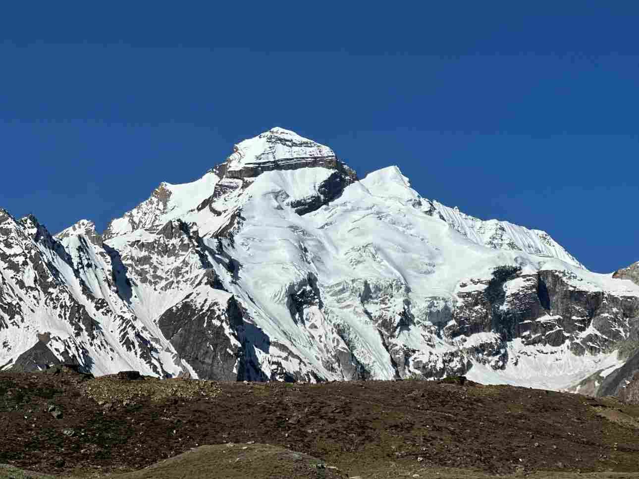
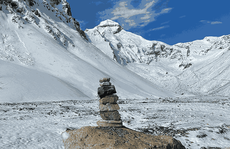
- Jyolingkong (Adi Kailash Base, 4,572 m): The sacred meadow basin at the foot of Adi Kailash.
Standing at Jyolingkong, the pyramidal summit of Adi Kailash rises to 5,945 m directly above — an
experience that pilgrims consistently describe as overwhelming. The Adi Kailash Temple at the
meadow's edge is a site of active worship.
- Parvati Sarovar: A pristine glacial lake adjacent to the Adi Kailash Temple at Jyolingkong.
Considered the Himalayan equivalent of Mansarovar Lake near Tibet's Mount Kailash. Ritual bathing
in the lake is considered highly auspicious. The water is crystal-clear and icy cold throughout the
year.
- Gauri Kund: A small sacred glacial pond situated between Jyolingkong and the base of Adi
Kailash. Dedicated to Goddess Parvati (Gauri), the pond is considered a site of divine feminine
energy. Many pilgrims offer prayers here before ascending toward the peak viewpoint.
Spiritual Significance
Adi Kailash is not merely a mountain — it is the earthly seat of Lord Shiva as described in multiple
Puranic texts including the Skanda Purana and Shiva Purana. Ancient pilgrims who could not undertake
the Tibet Kailash Mansarovar Yatra considered Adi Kailash their equivalent sacred destination. The
energy at Jyolingkong — with Parvati Sarovar in the foreground and the sheer Adi Kailash face above —
is described by pilgrims as profoundly still and charged with divine presence.
SEGMENT 4B | Gunji → Nabhidhang → Om Parvat Darshan
Route Overview
The right branch from Gunji leads northeast toward Nabhidhang — the viewpoint for Om Parvat. This
route follows a green dashed trail on the official route map and climbs to approximately 4,700 m at the
Nabhidhang viewpoint. Om Parvat darshan is typically combined with the Adi Kailash visit and done as a
full-day excursion from Gunji. The two viewpoints — Jyolingkong and Nabhidhang — can be visited on
consecutive mornings for best visibility.
Key Stops on This Segment
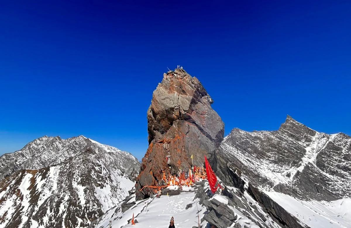
- Nabhidhang (4,700 m): The primary viewpoint for Om Parvat. A small ITBP post is located here.
The trail from Gunji to Nabhidhang involves a moderate ascent of approximately 3–4 km at high
altitude. Vehicles can reach part of the way; the final section is on foot.
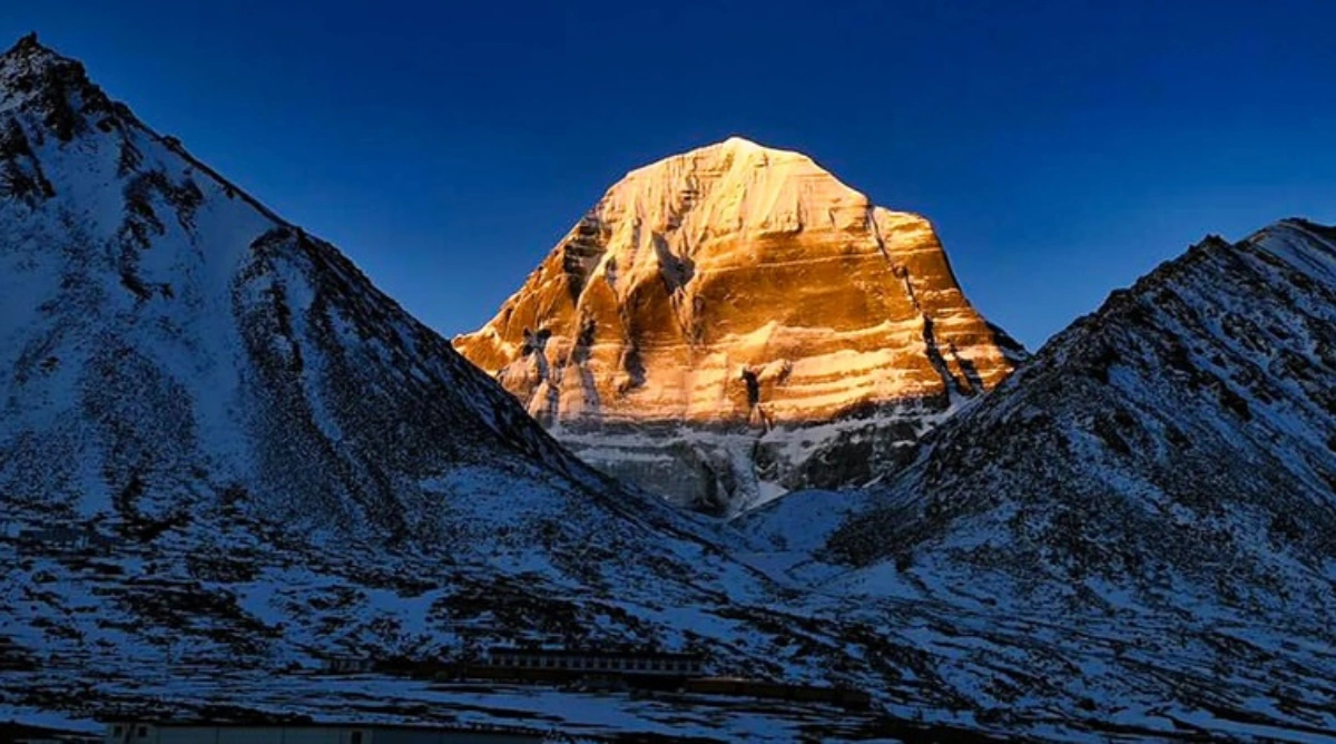
- Om Parvat: A neighbouring peak where natural snowfall adheres to dark rock in a pattern that
forms the exact Sanskrit symbol 'Om' (Aum) on the mountain face. This natural phenomenon is
visible from the Nabhidhang viewpoint on clear mornings. Cloud cover in the afternoon frequently
obscures the peak entirely — an early start before 7:00 AM is strongly recommended. Photography
is permitted but the view is best experienced with the naked eye in the still of dawn.
Adi Kailash Route Map: Complete Segment Summary
The table below maps every segment of the Adi Kailash route exactly as shown on the official route map
— from Kathgodam at the base to the twin sacred peaks at the summit.
| Segment | Route | Distance | Time | Key Highlights |
|---|
| 1 | Kathgodam → Pithoragarh | ~220 km | 7–8 hrs | Almora, orchards |
| 2 | Pithoragarh → Dharchula | ~91 km | 3–4 hrs | Kali River, ILP |
| 3 | Dharchula → Gunji | ~120 km | 5–6 hrs | Chialekh, Garbhyang |
| 4A | Gunji → Adi Kailash (Base) | ~30 km | 2–3 hrs | Kuti, Parvati Sarovar |
| 4B | Gunji → Om Parvat | ~15 km | 1.5–2 hrs | Nabhidhang viewpoint |
| 5 | Gunji → Dharchula | ~120 km | 4–5 hrs | Return descent |
| 6 | Dharchula → Kathgodam | ~250 km | 8–9 hrs | Almora, Bhimtal |
Essential Packing List for the Adi Kailash Yatra
Packing right is as important as planning the route. The weather on the Adi Kailash route changes
rapidly, and the nearest pharmacy above Dharchula is non-existent. Pack smart.
Clothing & Gear
- Thermal innerwear (top and bottom) — at least 2 sets
- Fleece jacket and heavy-duty down jacket for altitudes above 3,500 m
- Waterproof trekking pants and windcheater jacket
- Sturdy ankle-support trekking boots (broken in before the trip)
- Woollen socks, gloves, balaclava, and a warm hat
- UV-protection sunglasses (critical above 4,000 m)
- Trekking poles — highly recommended for the Jolingkong walk
Health & Medical Supplies
- Diamox (Acetazolamide) tablets — for altitude sickness prevention (consult doctor first)
- Pulse oximeter — to monitor blood oxygen saturation above 3,500 m
- Basic first-aid kit: bandages, antiseptic, pain relievers, ORS sachets
- Lip balm and high-SPF sunscreen (UV radiation is intense at altitude)
- Personal prescription medicines — carry more than needed
Documents & Essentials
- Original + photocopies of Aadhaar/Voter ID/Passport (minimum 6 copies each)
- 6–8 passport-size photographs
- Inner-Line Permit (arranged at Dharchula)
- Sufficient Indian cash — no ATMs beyond Dharchula
- Power bank (charging facilities are rare above Dharchula)
- Offline downloaded maps and GPS app (no internet connectivity above Gunji)
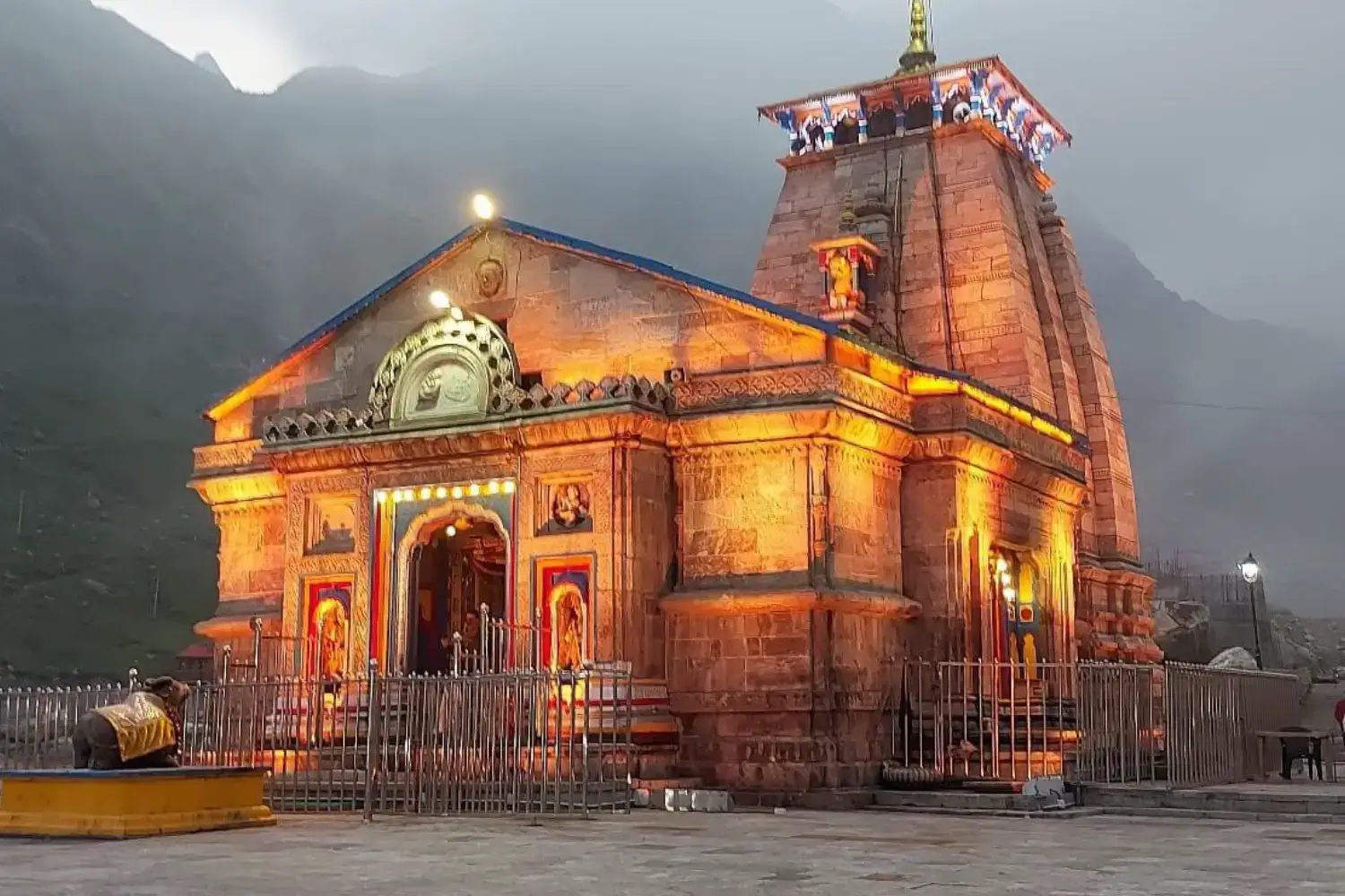
Final Thoughts: Your Adi Kailash Journey Awaits
The Adi Kailash route map is more than a travel itinerary — it is a roadmap to one of the most
transformative spiritual experiences available anywhere in India. From the ancient temple corridors of
Jageshwar Dham on Day 1 to the breathtaking silence of Parvati Sarovar at 4,572 m on Day 4, every
kilometre of this journey carries meaning.
The mountain roads are demanding, the altitude is real, and the permit process requires preparation. But
for travellers who approach the Adi Kailash Yatra with respect, adequate fitness, and a well-planned
itinerary, the rewards are immeasurable. Few journeys in the world offer the combination of natural
grandeur, cultural depth, and spiritual power that this route delivers.
Use this guide as your foundation. Cross-reference it with an experienced local operator, stay updated
on road conditions, and book your Kathgodam train tickets early. Then step onto that road to Adi Kailash
— and let the Himalayas do the rest.