

- Uttarakhand Tours
- Chandan_singh
You see a photo of a thin white ribbon of water dropping down a green cliff, and you want to go. Then you search for directions. One page says the falls are 14 km from Munsiyari. Another says 35. One says the drop is 120 metres, another 126. By the end, you are not sure whether to book a hotel in Munsiyari or somewhere else. This guide clears that up. You get Birthi Falls height, the distance from Munsiyari, Pithoragarh, Chaukori and Berinag, the best time to go, how the short walk works, where to stay and a simple trip plan.
Where sources disagree, you see the range.
What Is Birthi Falls?
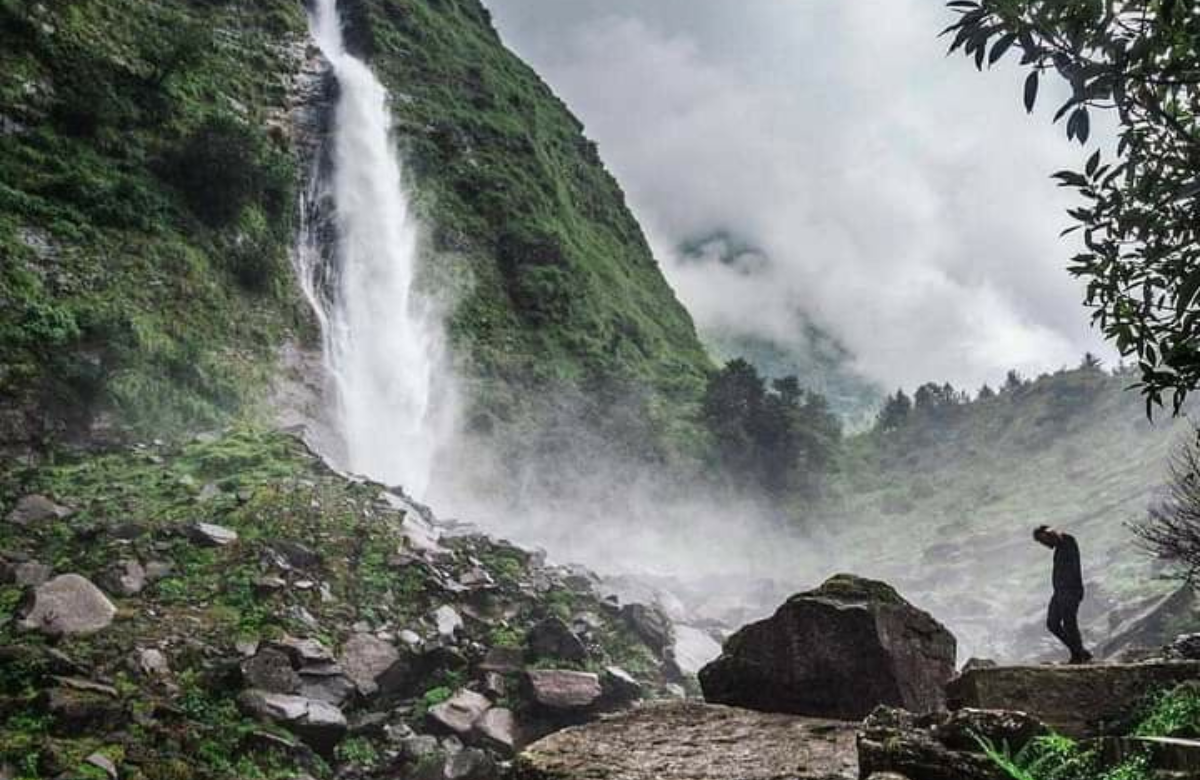
Birthi Falls is a tall waterfall in the Munsiyari area of Pithoragarh district, Kumaon, Uttarakhand. It sits on the road between Thal and Munsiyari, at an elevation reported as about 1,781 to 1,800 metres. The water drops in one long, uninterrupted line, which is why photographers like it. Some travel guides call it one of the tallest waterfalls in Uttarakhand.
The setting helps. You approach through pine and oak forest with Himalayan ridges in the distance, and the falls are a short, easy stop on the way to Munsiyari and the Johar Valley.
Birthi Falls Height: 120 or 126 Metres?
Sources do not agree on the exact height. Two pages give about 126 metres, another says 125 metres, and a caption in one of them says 120 metres. One guide mentions a flow height of about 400 feet, which is close to 122 metres.
Use about 120 to 126 metres when you write or speak about it, and avoid quoting a single exact figure as fact.
| Source Type | Height Stated |
|---|---|
| Travel guides (several) | About 125–126 m |
| One caption on a guide | 120 m |
| One guide (feet) | About 400 ft |
Birthi Falls Distance: From Munsiyari, Pithoragarh, Chaukori and Berinag
Distances vary by a few kilometres between guides, and some mix up the falls with the nearby village of Tejam.
Treat the table as a planning aid and ask your driver for the current figure.
| Starting Point | Distance to Birthi Falls | Note |
|---|---|---|
| Munsiyari | About 30–35 km | One page says 14 km, possibly measured from Tejam |
| Tejam | About 14–21 km | Two guides give different figures |
| Pithoragarh | About 100 km | Single-source figure for the district town |
| Chaukori | Roughly 60–70 km (estimate) | Worked out from Munsiyari to Chaukori at about 98 km |
| Berinag | No reliable figure published | Check on a map or with your driver |
| Kathgodam railway station | About 200–250 km | Sources differ |
| Delhi | About 520 km | Roughly 14 hours by road |
Birthi Falls to Munsiyari Distance
The falls lie before Munsiyari if you travel from Thal. Most guides put the distance at about 30 to 35 km, which takes around an hour on the winding road. The 14 km figure that appears on some pages is most likely the distance from Tejam, so do not plan around it.
Pithoragarh to Birthi Falls Distance
One guide places the falls about 100 km from Pithoragarh, the district headquarters. Another gives about 128 km from Pithoragarh to Munsiyari. These two do not fit neatly together, which is another reason to confirm locally. Allow most of a day for the drive from Pithoragarh via Thal.
Chaukori to Birthi Falls Distance
No guide gives this exact number. Chaukori to Munsiyari is about 98 km, roughly four hours by road, and the falls lie on the Chaukori side of Munsiyari at about 32 km from the town. Subtracting gives roughly 60 to 70 km. That is a calculation, not a measured figure, so treat it as a guide only.
Berinag to Birthi Falls Distance
Berinag is on the route into the Thal and Munsiyari road for some travellers, and one trip report lists Raiagar to Berinag at 6 km. Travel guides do not give a direct Berinag to Birthi Falls figure. Check it on a map, and plan for a long, slow day on mountain roads.
Birthi Falls Uttarakhand Distance from Major Cities
From Delhi, plan on about 520 km and a long drive. From Kathgodam station, expect roughly 200 to 250 km. The nearest airports are Pantnagar, about 215 to 280 km depending on the guide, and Naini Saini in Pithoragarh, about 100 km away.
How to Reach Birthi Falls
You reach Birthi Falls by road. There is no rail line or airport at the site itself. The usual route runs from Kathgodam or Haldwani through Almora, Thal and Tejam, then on towards Munsiyari. The falls are right beside the road, and a taxi will park you at the start of the path.
By Road
Drive or hire a cab from Kathgodam, Almora, Pithoragarh or Munsiyari. Shared cabs and buses run on the Thal to Munsiyari road.
By Train
Kathgodam is the usual railhead. Tanakpur is mentioned by one guide at about 150 km.
By Air
Pantnagar Airport is the nearest listed airport option, followed by a long road transfer. The road has narrow stretches and sharp bends. Landslides can slow you down, especially in the monsoon, so start early and keep your plans flexible.
The Walk to the Falls
The walk is short and suits most ages. It follows a paved path of about 0.5 to 1 km from the road and takes around 15 to 20 minutes. One guide mentions a trek fee of Rs 20, and another says there is no official fee, so ask at the gate. If you are short on time, you can see the falls from the main road. Adults on one trip found the climb tiring, so wear proper shoes and carry water.
There is not much to buy near the falls apart from a tea and snack stop mentioned by one guide, so bring water and a snack.
Best Time to Visit Birthi Falls
The best time depends on whether you want to see the waterfall at its fullest or prefer easier road and walking conditions.
| Season | What to Expect |
|---|---|
| March to June | Pleasant weather and safe walking. Lower flow than the monsoon. |
| July to August | Strongest flow, but heavy rain and landslide risk. Several guides advise caution or avoiding these months. |
| September to November | Good flow, clearer skies and a calmer road. |
| December to February | Cold, with slippery paths. Snow can restrict access. |
Guides disagree on the monsoon. One recommends July to October for the best flow, and another says to avoid July and August.
The sensible middle is September and October, when the water is still full and the rain has eased.
Where to Stay Near Birthi Falls
A Kumaon Mandal Vikas Nigam (KMVN) tourist rest house stands about 500 metres from the falls, and one guide notes that it is booked through the caretaker. Homestays and hotels are available in Tejam and Munsiyari. If the road is blocked by a landslide, Tejam can be a useful fallback.
Book ahead in the peak summer months.
Birthi Falls Munsiyari Trip: A Suggested Plan
This is a suggested plan for a Munsiyari trip that includes Birthi Falls. Adjust it for the season and road conditions.
| Day | Suggested Plan |
|---|---|
| Day 1 | Kathgodam to Chaukori or Tejam by road, with an overnight stop. |
| Day 2 | Morning visit to Birthi Falls, then on to Munsiyari by afternoon. |
| Day 3 | Local viewpoints around Munsiyari. Khaliya Top and Nanda Devi temple at Dana Dhar are mentioned by guides. |
| Day 4 | Return via Thal and Almora to Kathgodam or Delhi. |
Other places that guides link to the area include Namik Glacier, Kalamuni Top, Betulidhar and Thamri Kund.
Check road and weather conditions before you plan any of them.
Travel Tips for Birthi Falls
Keep these practical tips in mind before starting your journey:
Start early: Morning light is clear, and you avoid afternoon cloud and traffic.
Wear shoes with grip: The spray makes the path wet.
Carry cash, water and a snack: Options near the falls are limited.
Check weather and landslide reports: This is especially important during the monsoon.
Keep a buffer day: Hill roads can close without warning, so allow extra time for your return journey.
Booking Your Birthi Falls and Munsiyari Trip
If you are booking a Munsiyari trip, ask any operator for a written itinerary with the number of nights, vehicle type, pickup point and what happens if a road closes. Check whether Birthi Falls is a planned stop or only a passing photo halt, and whether the stay is in Munsiyari, Tejam or Chaukori.
Birthi Falls FAQ
1. What Is the Birthi Falls Height?
About 120 to 126 metres, depending on the source.
2. Where Is Birthi Falls Located?
In Pithoragarh district, Kumaon, Uttarakhand, on the Thal to Munsiyari road.
3. What Is the Birthi Falls to Munsiyari Distance?
About 30 to 35 km by road. One page says 14 km, which looks like the distance from Tejam.
4. What Is the Pithoragarh to Birthi Falls Distance?
About 100 km by one guide. Confirm locally, as another guide gives about 128 km from Pithoragarh to Munsiyari.
5. What Is the Chaukori to Birthi Falls Distance?
No direct figure is published. Munsiyari to Chaukori is about 98 km, so the falls are roughly 60 to 70 km from Chaukori. This is an estimate.
6. What Is the Berinag to Birthi Falls Distance?
No reliable figure is published. Check on a map or ask your driver.
7. What Is the Birthi Falls Uttarakhand Distance from Delhi?
About 520 km by road, roughly 14 hours.
8. How Long Is the Walk to Birthi Falls?
About 0.5 to 1 km, taking 15 to 20 minutes on a paved path.
9. Is There an Entry Fee for Birthi Falls?
Sources differ. One mentions Rs 20 for the walk and another says there is no official fee. Ask on arrival.
10. What Is the Best Time to Visit Birthi Falls?
September to October for full flow with easier roads. March to June also works. Be careful in July and August.
11. Is Birthi Falls Open in Winter?
The falls can be visited year-round, but winter paths are slippery and snow can restrict access.
12. Where Can I Stay Near Birthi Falls?
A KMVN rest house about 500 metres away, plus homestays and hotels in Tejam and Munsiyari.
Final Thoughts
Birthi Falls is a short stop with a big payoff. Plan for 30 to 35 km from Munsiyari, give yourself a night on the route and avoid the heaviest rain. Where the distances are fuzzy, ask your driver and your hotel before you set off.
Ready to plan your Munsiyari and Birthi Falls trip?