

- Uttarakhand Tours
- Chandan_singh
You have seen the photos. A long green valley, a river running white, villages tucked on the slopes and the Panchachuli peaks standing at the end of it all. Then you start planning, and the questions pile up. How high does the trek go? Do you need a permit? Which months are safe? Why does every website give a different distance?
This guide answers those questions plainly. It covers the Darma Valley trek in Pithoragarh district, Kumaon, with the altitude, the route, the best time to visit, the weather, the permit position and a day-by-day plan. Where sources disagree, which happens often here, you will see the range and why it matters.
What Is Darma Valley?
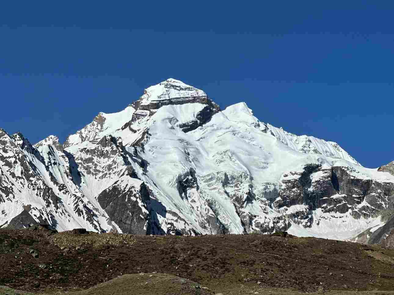
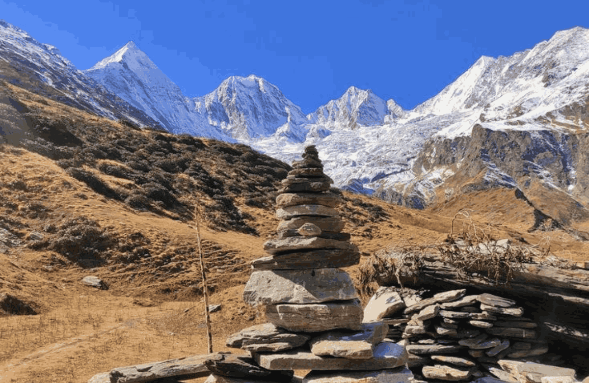
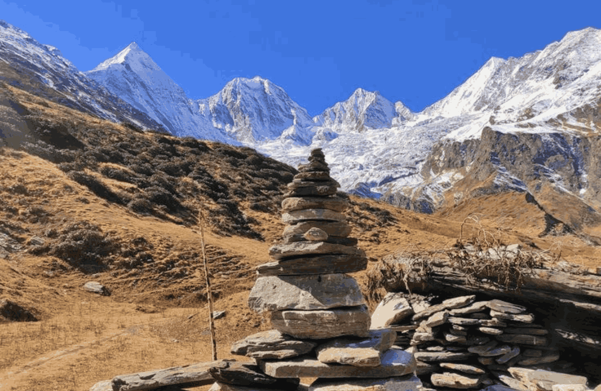
Darma Valley is one of the valleys of Pithoragarh district, in the far east of Kumaon close to the Indo-Tibetan border. The Darma River becomes the Dhauliganga at Tidang, and the Dhauliganga meets the Kali at Tawaghat, according to one guide. The valley is divided into Talla (lower) Darma at roughly 7,000 to 8,000 feet and Malla (upper) Darma, which reaches about 11,600 feet at Baun. People come for the contrast. The lower valley has forest, waterfalls and terraced fields. Higher up, the land opens into meadow, rock and glacier, with the Panchachuli massif rising to between 6,334 and 6,904 metres.
The valley has more than a dozen villages and fewer than a thousand people in total, with life built around livestock, trade and crops such as buckwheat and potatoes. Homestays and village visits are part of the experience.
One Valley, Several Spellings
You will see the same places spelled differently across websites. Dugtu, Duktu and Dantu refer to the same area, Panchachuli appears as Panchchuli, and Nagling appears as Nangling. Do not let it confuse you. Ask locally which spelling your guide uses.
Darma Valley Altitude and Height
This is the most searched detail, and it is also the least consistent. Sources give slightly different figures, so use the table as a guide and not as a survey.
| Place | Approximate Altitude |
|---|---|
| Sobla (valley entry) | About 1,670 m |
| Dar village | About 2,134 m (7,000 ft) |
| Sela | About 2,438 m |
| Baling and Nagling | About 2,743 m |
| Dugtu / Duktu / Dantu | About 3,048 m (one operator lists 11,500 ft) |
| Panchachuli Base Camp | About 3,960 m (12,992 ft) by one guide, about 14,000 ft by another |
| Darma (Niyo) Pass | 5,642 m (18,510 ft) |
| Panchachuli peaks | 6,334 to 6,904 m |
In short, the standard trek stays between about 1,670 m and the Dugtu area at roughly 3,000 m, and an extension to Panchachuli Base Camp takes you close to 4,000 m.
One guide describes the maximum altitude of the standard route as about 3,000 to 3,500 m, depending on the source. That is high enough for altitude effects, so pace yourself.
Darma Valley Best Time to Visit
Most sources agree on two good windows. The first is May to June, when days are pleasant, nights are cold and Panchachuli is usually visible. The second is mid-September to October, when the air is crisp and the views are at their sharpest. October is described as excellent for trekking and views. Avoid July to mid-September. Heavy rain makes trails slippery, and landslides and road blockages are common, so the views are often hidden. November to March is winter, with snow on the higher stretches. One guide notes that many families move down the valley, which limits homestay and food options. April is a shoulder month that only experienced trekkers should consider, since snowfall is still possible in March and April.
Best Season at a Glance
| Season | Months | What to Expect |
|---|---|---|
| Pre-monsoon | May to June | Clear skies, good trail conditions and cold nights |
| Monsoon | July to mid-September | Heavy rain, landslides and hidden views. Not recommended. |
| Post-monsoon | Mid-September to October | Stable weather and the sharpest mountain views |
| Winter | November to March | Snow on higher stretches, limited food and accommodation |
Darma Valley Weather
Weather in the valley changes with altitude and season, so expect warm afternoons low down and freezing nights near the top. One guide gives these approximate figures, though its seasonal and monthly numbers do not fully match, so treat them as a general picture.
Approximate Seasonal Temperatures
| Season | Daytime Temperature | Night Temperature |
|---|---|---|
| Spring (March to May) | About 3 to 22°C | About 8°C, with snow chances in March and April |
| Monsoon (June to September) | About 10 to 25°C | Cooler, with moderate to heavy rain peaking in July and August |
| Autumn (October to November) | About 3 to 18°C | About 0 to 7°C, with snow chances in November |
| Winter (December to February) | About -5 to 8°C | Around -5°C, and January is the coldest |
Another guide gives May daytime highs of 10 to 20°C with 0 to 5°C nights at higher camps, and 5 to 15°C days in autumn with nights well below freezing at Panchachuli Base Camp.
The pattern is consistent even if the numbers vary: days can feel mild, and nights near the top are cold.
Weather and Packing Tips:
Pack warm layers for cold nights.
Carry waterproof clothing for unexpected rain.
Check the forecast the day before you start.
Expect afternoon rain to arrive earlier than you hope.
How Hard Is the Darma Valley Trek?
Sources rate the difficulty from easy to moderate on one operator's page to moderate to difficult on another's. The truth sits in the middle. The trail itself is not technical, but the days are long, parts are steep and the altitude adds effort.
One operator notes that the walking legs add up to roughly 60 to 65 km over the standard route, while another describes a much shorter 8 to 10 km round trip from Dugtu to Panchachuli Base Camp. That difference comes from where each operator starts walking, since roads now reach far up the valley. You need steady cardiovascular fitness and strong legs. One operator suggests a four-week training plan that builds from brisk walks to incline and weighted hikes. If you have knee or joint trouble, or any heart or serious medical condition, talk to your doctor before you commit.
The Darma Valley Route
The classic trek starts after a long drive from Kathgodam. The route runs through Bhowali, Almora, Berinag and Pithoragarh to Dharchula. Kathgodam to Dharchula is about 337 km in one itinerary and nearer 410 km in another. One guide puts the drive from Delhi at around 585 km over two days. From Dharchula you continue towards Tawaghat and Sobla, then to Dar, where the walking begins in earnest.
Main Trek Route
The standard route follows the river upstream:
Dharchula
Tawaghat
Sobla
Dar
Sela
Baling
Nagling waterfall
Dugtu / Duktu / Dantu
Panchachuli Base Camp
From Dar you walk to Sela, then to Baling and the Nagling waterfall, then on to Dugtu. From Dugtu you make a side trip to Panchachuli Base Camp, which is about 4 to 5 km from the village. One operator's route continues to Sipu for Panchachuli views. You return along the same valley, with an extra buffer day built in for weather.
A Road Now Reaches Far Up the Valley
One guide notes that a BRO road reaches near Dugtu and Dantu in good weather, and several operators offer a short version that drives most of the way, with only the final stretch on foot. The full trek still gives you the valley at walking pace, but the shorter option suits people with less time. Road status changes with the weather, so ask before you commit.
Shorter Road-and-Trek Option
If you have less time, a shorter plan drives from Dharchula to Dugtu in about three to four hours, treks to Panchachuli Base Camp, spends a day exploring the villages and returns by road. One operator lists this as a seven-day trip including the drives from and to Kathgodam. It trades the full walk for more time at the top.
Permits for the Darma Valley Trek
The valley sits near the international border, so permits matter. Sources differ on how strict they are, which is reason enough to prepare for the stricter reading.
Inner Line Permit (ILP)
One guide says the ILP is free for Indian nationals and issued the same day at the SDM office in Dharchula. It adds that the basic trek to Dugtu is technically not mandatory, yet ITBP checkposts at Sela and Baling register trekkers, so having one smooths the process. Another guide says the ILP is required because of the border location.
Beyond Dugtu
The same first guide says an ILP is required for Om Parvat, Lipulekh Pass and Gunji.
Foreign Nationals
A Protected Area Permit is needed and takes longer. Rules change, so confirm with the local administration or a registered operator.
Documents to Carry
Original government photo ID.
Photocopies of your ID.
Passport-size photographs.
A list of all group members.
Important: Do not rely on a permit-free trek. Process the ILP in Dharchula as part of your first-day checks, and ask your operator what they handle for you.
Safety and Altitude Advice
This is a remote valley. Mobile network is weak or absent, so tell family your plan before you leave.
Roads can close in bad weather, so keep a buffer day in your schedule.
Important Safety Tips
Acclimatise: Increase height gradually and do not rush ascent days.
Report symptoms early: Headache, nausea or breathlessness should be reported to your guide at once.
Start early: Begin and finish hikes before noon, since afternoon rain is common.
Hire local guides: Local knowledge is important in a remote valley.
Carry your waste out: Help keep the valley clean.
Insurance: One operator requires adventure or trek insurance. A medical fitness certificate, issued within seven days of the trek, is required for participants aged 60 and above.
This is general guidance, not medical advice. If you have a health condition, speak to a doctor before you go.
What to Pack for the Darma Valley Trek
Pack for cold nights and wet afternoons. The weather can change quickly, especially at higher elevations.
Trekking Essentials
Backpack with a rain cover.
Waterproof trekking shoes.
Trekking poles.
Sun cap.
Sunglasses.
Headlamp.
Clothing
Fleece layer.
Waterproof jacket or poncho.
Warm padded layers, especially in autumn.
Comfortable trekking clothes.
Extra socks.
Personal and Medical Essentials
Water bottle.
Power bank.
Biodegradable soap.
Sunscreen.
Lip balm.
Small first-aid kit.
Personal medicines.
Blister-care supplies.
Altitude sickness tablets appear on one operator's list, so ask your doctor what suits you.
Beyond the Standard Trek: Sinla Pass
One guide describes the Sinla Pass as a route for experienced trekkers that links Darma with the Byans Valley. It is much higher than the standard route, requires proper permissions and gear and needs a guide. Treat it as a serious high-altitude crossing, and not as a casual extension.
Combine the Trek With Other Kumaon Places
The drive to Dharchula passes some of Kumaon's best-known places, so you can turn a long approach into part of the trip. Almora, Kausani, Ranikhet and Binsar are all mentioned as possible stops on the way, and one itinerary returns via Jageshwar Temple and Kasar Devi. Our guides to Almora, Jageshwar Dham and Places to Visit in Kumaon will help you plan the stops.
Final Thoughts
The Darma Valley trek is the kind of journey that rewards preparation. Pick your month with care, respect the altitude, carry your permit and keep a spare day for the weather. Do that, and you get a long river valley, quiet villages and the Panchachuli peaks at the end of it. Book early for the May to June and autumn windows.
Ready to plan your Darma Valley trek?