

- Uttarakhand Tours
- Chandan_singh
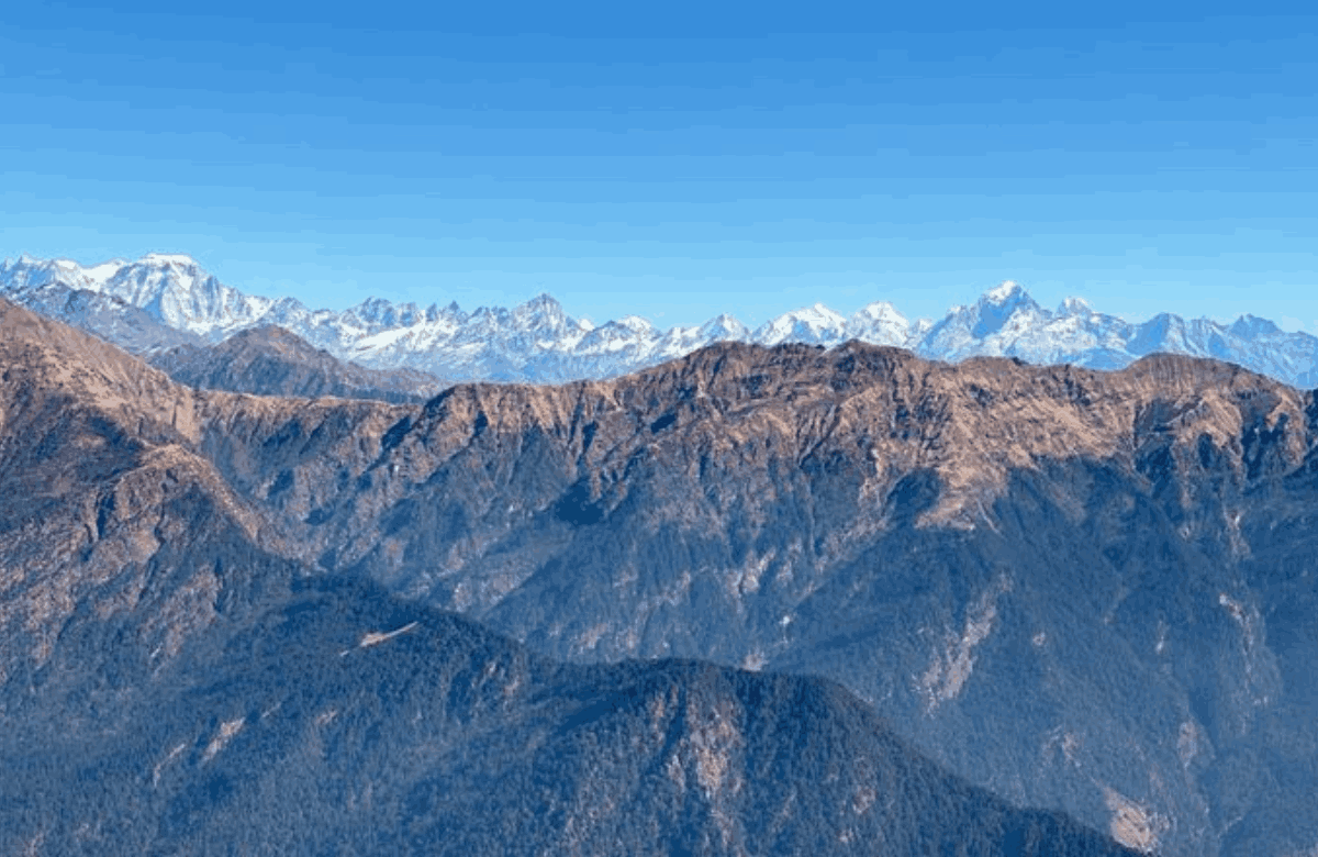
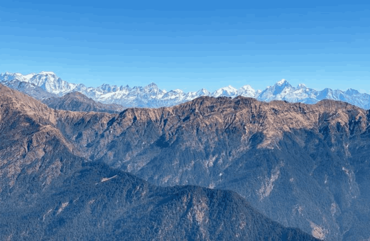
You have seen the photo: a windy summit at sunrise, with Nanda Devi, Trishul and Chaukhamba lined up like a wall. So you start planning. Then the numbers stop matching. One page says the Chandrashila trek is 4 km. Another says 10. One says it takes three hours, another seven. One says the peak is 4,000 metres high, another says 3,690. By the time you finish reading, you do not know whether you need a day trip, a three-day package or a pair of snow boots. This guide settles the confusion. You get the Chandrashila trek distance from Chopta in kilometres, the real story behind the height figures, how long the walk takes, the best time to go, what it costs, how to reach Chopta from Delhi and how to plan the days around it.
You also get the context that most quick guides skip: the legends, the trail stage by stage, altitude safety, where to stay and what to eat. Where sources disagree, you see the range, so you can decide with open eyes.
Chopta Chandrashila Trek at a Glance
| Detail | Figure |
|---|---|
| Trek starts at | Chopta, about 2,680 m (about 8,790 ft) |
| Chopta to Tungnath | About 3.5 km (some pages say 3 to 4 km) |
| Tungnath to Chandrashila | About 1.5 km |
| Total, one way | About 5 km |
| Round trip | About 10 km (one operator counts about 11 km) |
| Time on trail | About 6 to 8 hours for the full day |
| Difficulty | Easy to moderate |
| Best months | April to June, September to October |
| Nearest big towns | Ukhimath, Rudraprayag, Gopeshwar |
What Is the Chopta Chandrashila Trek?
Chopta is a meadow village in Rudraprayag district, Uttarakhand, surrounded by rhododendron and oak forest. Travellers often call it the "mini Switzerland of India". It is the base for a short, high walk that links two places: Tungnath, a Shiva temple, and Chandrashila, a summit with a 360-degree view of the Garhwal Himalaya. The trek is short compared with most Himalayan routes. You do not need a multi-day approach or technical skills. A stone-paved pilgrim path takes you most of the way up.
What makes it special is how quickly the scenery changes. You start in forest, cross open meadows called bugyals, and finish on a bare, windy ridge where the peaks fill the horizon.
Tungnath and the Panch Kedar Story
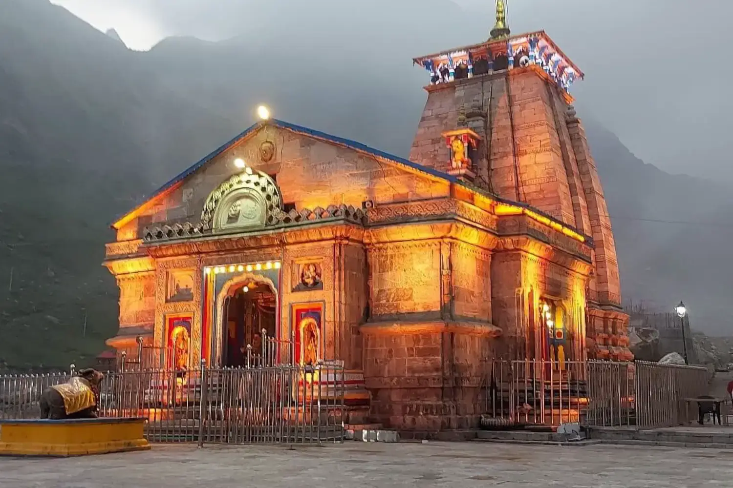
Tungnath is counted among the Panch Kedar, the five Shiva temples of Garhwal, and is also called Tritiya Kedar, the third Kedar. Local tradition links the temples to the Pandavas, who are said to have sought Shiva's forgiveness after the Mahabharata war. Tungnath is described as one of the highest Shiva temples in the world. The name Chandrashila means "Moon Rock". Legends tell of different figures doing penance here, including Rama, Ravana and the moon god Chandra, depending on who tells the story. Treat these as local tradition rather than settled history. They add colour to the climb, and many pilgrims walk the route as much for faith as for the view.
Chandrashila Trek Distance and Chandrashila Trek KM
This is the number most people search for, so here it is in plain terms.
Guides agree on the big picture. They differ on small details because trail lengths are rounded and some pages measure from different starting points.
| Section | Distance | Note |
|---|---|---|
| Chopta to Tungnath temple | About 3.5 km (3 to 4 km across guides) | Paved stone trail with switchbacks |
| Tungnath to Chandrashila summit | About 1.5 km (one itinerary says 1 km) | Steeper, with loose rock near the top |
| Chopta to Chandrashila, one way | About 5 km | Sum of the two sections |
| Chopta to Chandrashila and back | About 10 km | One operator lists about 11 km |
| Chopta to Tungnath and back | About 7 km | If you skip the summit |
Chandrashila Trek Distance from Chopta
From Chopta, plan on about 5 km each way. The first 3.5 km is the easy part, with a steady gradient on a paved path. The last 1.5 km is the real climb. It gains close to 1,000 feet over loose ground, and the wind picks up as you rise.
Why Do Some Pages Say 4 km, 5.5 km or 15 km?
You may see a figure like 15 km on a trek package page. That number usually covers the whole programme, including side walks such as Deoria Tal, rather than the Chandrashila route alone. A figure of 4 km often covers only the Chopta to Tungnath stretch.
When you compare operators, ask exactly which sections the distance includes.
Chandrashila Trek Height: 4,000 Metres or 3,690 Metres?
This is the biggest conflict in Chandrashila information, and it is worth understanding. Many guides and trek operators quote the summit at about 4,000 metres (13,123 feet). Other well-known guides give about 3,690 metres (about 12,083 feet).
Tungnath temple is consistently quoted at about 3,680 metres (12,073 feet), which sits very close to the lower summit figure.
| Point | Commonly Quoted Height |
|---|---|
| Chopta | About 2,680 m (8,790 ft). A few pages give 2,600 to 2,900 m. |
| Tungnath temple | About 3,680 m (12,073 ft) |
| Chandrashila summit | About 4,000 m (13,123 ft) on many pages, or about 3,690 m (12,083 ft) on others |
If you write about the trek, say "about 4,000 metres by common reckoning, though some guides list it closer to 3,690 metres." The honest answer is that the summit is roughly 1,000 to 1,300 metres above Chopta, which is plenty of altitude for a one-day walk.
Whichever number is right, treat the climb seriously.
Chandrashila Trek Time: How Long Does It Take?
Time depends on fitness, weather and how often you stop for photos. Most guides give a range, and the ranges overlap.
| Stage | Typical Time |
|---|---|
| Chopta to Tungnath | About 2 to 3 hours (a few guides allow 4 to 5 for slow groups) |
| Tungnath to Chandrashila | About 1 hour, and longer with snow or altitude symptoms |
| Chopta to Chandrashila | About 3 to 5 hours |
| Full day, up and down | About 6 to 8 hours |
The descent takes about half the climbing time, according to one guide. Most people aim to reach the summit before noon, because cloud often builds in the afternoon and hides the peaks. Start early, around 5 to 6 AM if you want sunrise light, and keep a buffer for the walk back.
The Trail, Stage by Stage
Knowing what each section looks like helps you pace yourself.
Stage 1: Chopta to the First Meadow
The path starts as a paved stone track with a series of bends. Forest on both sides keeps the early climb cool. After about an hour, one guide describes a meadow with dhabas where you can sit, drink tea and eat. Use this stop to settle your breathing, not to race ahead.
Stage 2: The Long Ridge to Tungnath
The forest thins and the views open up. The trail stays paved and the gradient is steady. A short detour to Ravanshila, a rock tied to the Ravana legend, is mentioned about ten minutes before the temple. Tungnath itself sits in a small stone complex with food stalls and, in season, simple dormitories.
Stage 3: Tungnath to Chandrashila
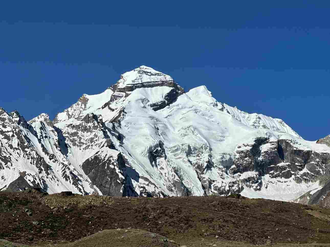
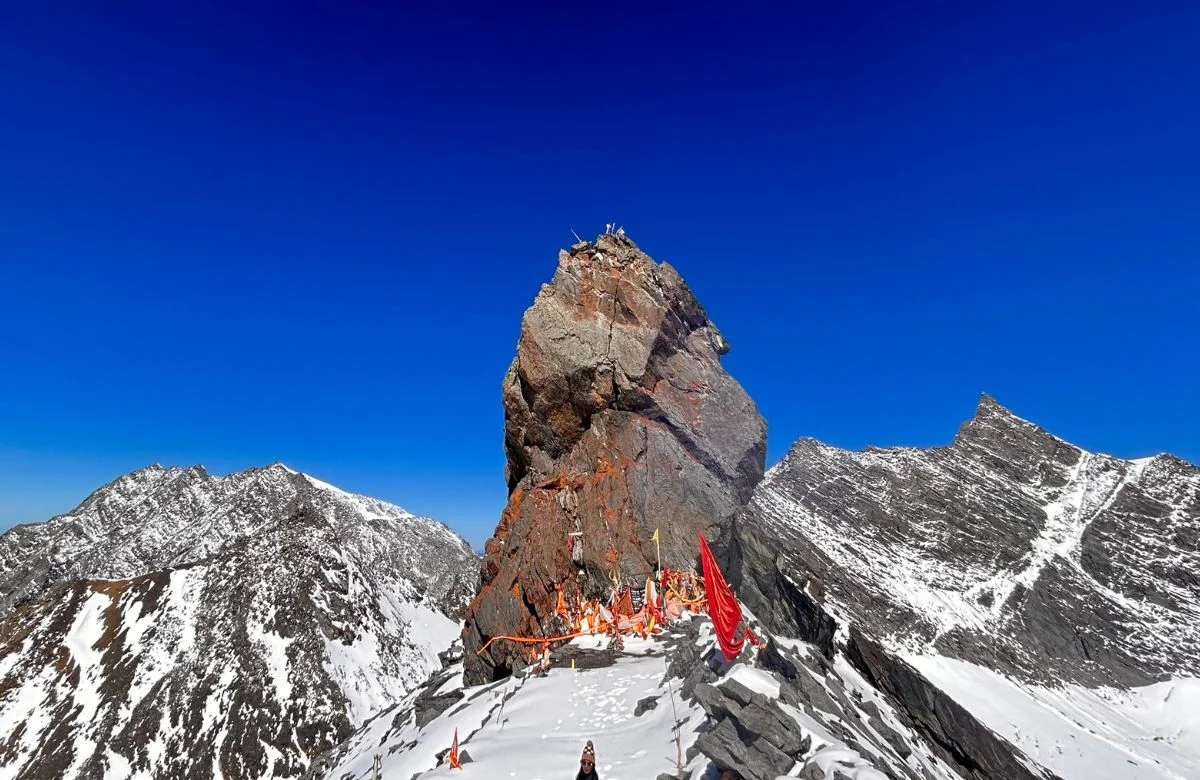
This is the hardest part. The paved path ends and the climb steepens over loose ground. The last stretch is windy and cold even in summer. At the top you get a 360-degree view. On a clear day that includes Nanda Devi, Trishul, Chaukhamba and the Kedarnath range. Cloud can wipe the view out in minutes, which is why early starts matter.
How Difficult Is the Chandrashila Trek?
Guides rate it easy to moderate. A beginner with reasonable fitness can do it. The trek is not hard because of technical ground. It is hard because of altitude, wind and the steep final section. One guide suggests you should be able to walk about 5 km comfortably before you try, and one operator suggests about six weeks of training with walking, stair climbing and light strength work.
A Suggested Six-Week Preparation Plan
Weeks 1 to 2: Short daily walks and breathing practice.
Weeks 3 to 4: Build to 60-minute walks and add stairs.
Weeks 5 to 6: Add squats, lunges and uphill walking with a backpack.
Altitude Safety and Acclimatisation
You climb from about 2,680 metres to well above 3,600 metres in a day, so altitude sickness is possible.
Watch for:
Headache
Dizziness
Nausea
Breathlessness
Walk slowly, drink water and do not rush the first day. If symptoms appear and do not ease with rest, go down. One guide advises descending to Chopta if symptoms continue. Spending a night at or near Chopta before the climb helps your body adjust.
Chandrashila Trek Best Time
The trek is possible for much of the year, but each season gives a different trip. Choose by what matters most to you: an open temple, flowers, clear views or snow.
| Season | What to Expect |
|---|---|
| April to June | Pleasant weather, about 10 to 20°C by day. The temple reopens. Rhododendrons bloom in spring. |
| July to mid-September | Monsoon. Landslides, cloud and slippery paths. Most guides advise avoiding it. |
| Mid-September to October | Clearest views of the Himalayan range, with cold nights. |
| November to early December | Dry and cold, and some guides describe views as flat. The temple has closed for winter. |
| December to March | Heavy snow on the upper trail. Beautiful, but ice and snow make it unsafe to try alone, and accommodation near the top is unavailable. |
Tungnath Temple Dates
The temple opened in late April or early May 2026 and was expected to close in early November, with the exact dates set each year by the Badri-Kedar Temple Committee. Sources gave 22 April and 2 May as the 2026 opening date, so they are best treated as indicative. If you plan a 2027 trip, check the announced opening and closing dates before you book. In winter the idol is worshipped at another location, and you can still make the walk, but there are no rituals at the top.
What Is Usually Included?
Packages commonly cover:
Stay
Vegetarian meals
Forest permits
Trek leader
Common exclusions are your travel to the starting point, some meals, personal expenses, GST and insurance.
Two operators describe the stay differently, so one lists a guesthouse while another mentions tents. Ask for written inclusions before you pay.
Permits and Paperwork
One guide says no trek permit or temple entry fee is needed, and a guide is not required outside winter. Some operators include forest permits in the package and ask for a medical certificate and an ID. Rules change, so confirm with your operator or the forest office. Carry your original ID and photocopies in any case.
Cash and Connectivity
One guide notes Chopta has no ATM or petrol pump, with the nearest useful ones in Ukhimath, Rudraprayag or Gopeshwar. Digital payments can be unreliable, because phone signal is patchy. Carry enough cash for food, porters and tips before you reach Chopta.
Chandrashila Trek from Delhi: Route, Distance and Transport
Delhi is a popular starting point. The distance from Delhi to Chopta is reported as about 415 to 450 km, depending on the route and where the guide measures to. Google Maps shows about 10 hours 20 minutes of non-stop driving, and most people need 11 to 13 hours with stops.
The usual route runs:
Delhi → Haridwar → Rishikesh → Devprayag → Srinagar → Rudraprayag → Ukhimath → Duggalbitta → Chopta
| Starting Point | Distance to Chopta | Approx. Time |
|---|---|---|
| Delhi | About 415–450 km | 10–13 hours |
| Haridwar | About 225 km (one guide) | 7–8 hours |
| Rishikesh | About 165–212 km (guides differ) | 5.5–9 hours |
| Dehradun | About 243–250 km to Tungnath | 7–9 hours |
By Road
Self-drive or hire a cab from Delhi. Start before dawn to clear the plains, and plan fuel before the hills. One guide advises avoiding night driving beyond Rudraprayag or Ukhimath after about 6 PM, since the roads are narrow and fog and landslides are common.
By Bus and Train
Buses run from Delhi's Kashmere Gate ISBT to Rishikesh, Rudraprayag and Ukhimath, according to one guide. From there, shared jeeps and taxis go to Chopta. By train, go to Haridwar or Rishikesh and continue by road. There is no direct Delhi to Chopta service, so you book each leg separately.
By Air
Jolly Grant Airport in Dehradun is the nearest major airport. A flight from Delhi saves the plains drive, and then you continue by road for the long mountain stretch.
Where to Stay Near Chopta
Stay options sit at several points along the route, and booking far ahead is usually not necessary outside peak season, according to one guide. However, you should still confirm availability in May and June.
Chopta: Guesthouses, homestays and campsites near the trailhead. The best choice if you want an early start.
Sari Village: A quiet base used by some operators, near the route to Deoria Tal.
Duggalbitta and Baniyakund: Smaller stops on the way, quieter than Chopta.
Ukhimath and Gopeshwar: Larger towns with more hotel choice and facilities.
Tungnath: Simple dormitories in the main season. These are not available in winter and early April.
Food on the Trail
You find dhabas and small restaurants at Chopta, along the path and at Tungnath. Menus are often not printed and prices run high, because everything is carried up. Ask the price before you order. Carry snacks such as nuts, biscuits and chocolate, and carry water, since the upper part has few stops.
Deoria Tal as an Add-on
Deoria Tal is a small lake reached from Sari village. One guide says the walk from the campsite takes about two hours. Campsites should be booked ahead, and bonfires are not allowed because the area is a wildlife sanctuary. The lake is best at sunrise and sunset. It makes a gentle second day after the Chandrashila climb.
What to Pack for the Chandrashila Trek
Pack for changing mountain weather, cold winds and an early start.
A windproof and waterproof jacket, and a warm layer such as fleece or down.
Full-sleeve tops and trek pants. Avoid jeans.
Trekking shoes with good grip and a few pairs of socks.
Woollen cap, gloves, sunglasses, sunscreen and lip balm.
Headlamp or torch for an early start, a water bottle and a power bank.
Basic medicines, plasters and a plastic bag for electronics.
Original ID with photocopies, a medical certificate if your operator asks, and cash.
Trekking poles help on the descent, particularly if the path is wet or icy.
Safety and Responsible Trekking
Most problems on this trek come from rushing and weather.
Keep to the marked path, stay with your group and turn back if the weather closes in.
In winter, snow and ice make the upper trail risky, and one guide says it is unsafe to attempt alone.
Carry your rubbish back down, avoid plastic and respect the temple area.
Chopta lies in a protected forest region, so do not light fires or disturb wildlife.
Birdwatchers may spot the Himalayan Monal, and one guide counts more than 200 bird species in the area.
How to Book the Chandrashila Trek
If you are booking a package, compare more than the headline price.
Ask these questions before making a payment:
Where does the package start, and is transport from Delhi, Haridwar or Rishikesh included?
How many nights are there, and where do you sleep each night?
Are meals, permits, guide and porter included?
What happens if rain, snow or a landslide stops the trek?
What are the cancellation and refund terms?
Read the inclusions closely, since two packages with the same price can cover very different things..
Final Thoughts
The Chandrashila trek is short, but it gives a lot back. Plan on about 5 km each way, start early, pick your month to match what you want to see and give yourself time to adjust to the altitude. If you are travelling from Delhi, treat the drive as part of the journey and add a buffer day.With those pieces in place, the confusing numbers become a clear plan.
Ready to plan your Chopta Chandrashila trek?