Rishikesh to Kedarnath Distance: Complete Road Guide with Every Kilometre
Planning the rishikesh to kedarnath journey is one of those things that reveals just how much the
internet disagrees with itself. Ask three websites for the distance and you get three different numbers —
216 km, 247 km, 253 km — with no explanation for the variation. Ask about travel time and the answers
range from 7 hours to 12 hours. No one mentions that Kedarnath is actually not accessible by road at all
for the final 16 to 18 km — that section is a trek from Gaurikund — and very few sources explain which
route to take, where to stop for the night, or how the distance from Rishikesh to Kedarnath fits into a
larger Chardham journey.
This guide settles all of that. Here is the exact rishikesh to kedarnath distance by road, broken down
stage by stage with landmarks, altitude, overnight halt points, and realistic driving times. We also cover
the return kedarnath to rishikesh distance, the distances to and from Haridwar, and how Kedarnath
connects to the other three Chardham shrines on the kedarnath-badrinath gangotri yamunotri map.
Rishikesh to Kedarnath Distance: The Straight Answer
The rishikesh to kedarnath distance by road from Rishikesh town to Gaurikund — the trailhead at the
base of the Kedarnath trek — is approximately 216 to 225 km. The variation in that range comes from
which specific entry point in Rishikesh you start from and which road you take through the Rudraprayag
junction. Most GPS applications will give you a figure around 216 km on the shorter Devprayag route or
225 km via the Srinagar (Garhwal) bypass.
It is critical to understand that this road distance does not get you to Kedarnath temple. The temple sits
at 3,553 metres above sea level, and the road ends at Gaurikund at 1,982 metres. The remaining 16 to
18 km is a mountain trek on foot, by pony, or by doli (palanquin). If you choose the helicopter option,
you fly from Phata or Sirsi helipad — both are accessed by road before the Gaurikund trailhead — to
the Kedarnath helipad, which is approximately 500 metres below the temple.
The rishikesh to kedarnath distance by car is the same 216 to 225 km road section, typically taking 7 to
9 hours in good conditions. The mountain roads through the Garhwal Himalayas are single-lane in many
sections and the driving pace is significantly slower than on plains highways — even though the
distance looks modest, never plan to complete this drive and the subsequent trek on the same day.
Rishikesh to Kedarnath by Road: Stage-by-Stage Route Guide
The rishikesh to kedarnath by road journey passes through some of the most beautiful river valley
scenery in Uttarakhand — the confluence towns of Devprayag, Rudraprayag, and the dramatic gorge
approach to Sonprayag and Gaurikund. Understanding the staging helps you plan your night halts
correctly and avoid the common mistake of arriving at Gaurikund too late to begin the trek at a sensible
hour.
Stage 1 — Rishikesh to Devprayag: 71 km
The drive from Rishikesh begins along the banks of the Ganga on NH-58, climbing gradually into the
Garhwal foothills through Shivpuri, Byasi, Kaudiyala, and Kalyasaur. Devprayag at 618 m is one of the
most sacred of the five Prayags — the point where the Alaknanda and Bhagirathi rivers merge to form
the Ganga. This is worth a short stop if timing permits. The 71 km from Rishikesh to Devprayag takes
approximately 2 to 2.5 hours in normal traffic — expect it to take longer on peak pilgrimage days in May
and June.
Stage 2 — Devprayag to Rudraprayag: 76 km
From Devprayag the road continues along the Alaknanda river through Srinagar (Garhwal) — not to be
confused with Srinagar in Kashmir — which is the largest town on this route and a useful fuel and food
stop. Rudraprayag at 895 m, approximately 76 km from Devprayag, is another sacred confluence — the
Alaknanda and Mandakini rivers meeting here. From Rudraprayag, the road splits: left goes to
Badrinath and right toward Kedarnath. This junction is where the rishikesh to kedarnath by road route
turns southeast into the Mandakini valley. Driving time from Devprayag to Rudraprayag is approximately
2.5 hours.
Stage 3 — Rudraprayag to Sonprayag via Guptkashi: 70 km
After Rudraprayag, the road enters the Mandakini valley and begins to climb more seriously. Agastmuni
and Tilwara are small roadside towns passed en route. Guptkashi at 1,319 m is the most significant halt
town on the Kedarnath route — it has good hotels, restaurants, and is the last comfortable overnight
option before the trek begins. Many pilgrims choose to spend the night here rather than pushing all the
way to Sonprayag or Gaurikund on day one. Sonprayag, at approximately 1,829 m, is the check post
where government registration QR codes are verified — without a valid registration, no pilgrim is
allowed beyond this point. The Rudraprayag to Sonprayag section covers approximately 70 km and
takes 2.5 to 3 hours.
Stage 4 — Sonprayag to Gaurikund: 5 km
The final 5 km from Sonprayag to Gaurikund is a narrow mountain road that can only be accessed by
government-authorised local vehicles — private cars and tourist vehicles must park at Sonprayag and
take the designated government buses or share jeeps to Gaurikund. This rule is enforced strictly.
Gaurikund at 1,982 m is the official trailhead for the Kedarnath trek. This is where the rishikesh to
kedarnath distance by road ends and the trek begins.
Rishikesh to Kedarnath Distance by Road: Complete Stage
Reference
Here is the complete stage-by-stage distance reference for the rishikesh to kedarnath distance by car,
including the trek section from Gaurikund to the temple.
| Stage | Section | Distance | Altitude Range | Time |
| 1 | Rishikesh → Devprayag | 71 km | 356 → 618 m | 2–2.5 hrs |
| 2 | Devprayag → Rudraprayag | 76 km | 618 → 895 m | ~2.5 hrs |
| 3 | Rudraprayag → Sonprayag | 70 km | 895 → 1829 m | 2.5–3 hrs |
| 4 | Sonprayag → Gaurikund | 5 km | 1829 → 1982 m | 15–20 min |
| Road Total | Rishikesh → Gaurikund | ~222 km | 356 → 1982 m | 7–8 hrs |
| Trek | Gaurikund → Kedarnath Temple | 16–18 km | 1982 → 3553 m | 6–8 hrs |
| Full Total | Rishikesh → Kedarnath (overall) | ~238–240 km | 356 → 3553 m | ~2 days minimum |
How Long Does the Rishikesh to Kedarnath Drive Actually Take?
The rishikesh to kedarnath distance by car of 216 to 225 km takes most drivers 7 to 9 hours to
Gaurikund under normal conditions. This is significantly longer per kilometre than a plains highway drive
because the roads through the Garhwal Himalayas are mountain single-lane roads with sharp curves,
gradients, and significant traffic during the May–June and September–October peak seasons.
Pilgrims who try to drive from Rishikesh to Gaurikund and then begin the trek on the same day
consistently report exhaustion before they even reach the base of the climb. The standard
recommended itinerary is: Day 1 — drive from Rishikesh and overnight at Guptkashi or Sonprayag; Day
2 — drive to Gaurikund early morning and begin the trek to Kedarnath; Day 3 — darshan and descent to
Gaurikund; Day 4 — drive back to Rishikesh or continue to the next Chardham shrine.
Traffic on the Rishikesh to Kedarnath road peaks dramatically during Akshaya Tritiya (the opening of
the temples, usually late April) and during the school holiday window in May–June. The Sonprayag to
Gaurikund section is particularly prone to bottlenecks. If you are travelling during peak season, budget
an additional 2 to 3 hours on the road distance estimate.
Kedarnath to Rishikesh Distance: The Return Journey
The kedarnath to rishikesh distance on the return journey is the same road — approximately 216 to 225
km from Gaurikund to Rishikesh — taking 7 to 8 hours by car. The descent from Gaurikund to Rishikesh
is marginally faster than the ascent because the steeper mountain sections are more manageable going
downhill and traffic flow tends to be lighter on the descent side of the road.
Most pilgrims complete the trek descent from Kedarnath to Gaurikund in 4 to 5 hours and then drive
immediately to Guptkashi or Rudraprayag for the night before completing the kedarnath to rishikesh
distance drive the following morning. Attempting the trek descent and the full road drive to Rishikesh in
a single day is possible but tiring — most families and older pilgrims split this into two days.
Kedarnath to Haridwar Distance: The Most Used Gateway Route
Haridwar is the most common rail junction for pilgrims arriving from other parts of India for the
Kedarnath yatra, and the kedarnath to haridwar distance is therefore a frequently searched number.
The road distance from Gaurikund (Kedarnath trailhead) to Haridwar is approximately 230 to 240 km,
taking 7 to 9 hours via Rudraprayag and Rishikesh.
The Haridwar to Kedarnath (Gaurikund) road passes through Rishikesh — approximately 24 km from
Haridwar — making the Haridwar to Gaurikund journey approximately 240 to 250 km in total. Many
pilgrims find it easier to book packages from Haridwar since it is a major railway terminus with far better
national train connectivity than Rishikesh. Nagarjuna Travels' Kedarnath Dham Package departs from
Haridwar, includes comfortable hotel stays in Sonprayag and Guptkashi, assistance with yatra
registration, and optional helicopter darshan — the most practical option for families and first-time
pilgrims who want to avoid logistics stress on the mountain road.
Kedarnath-Badrinath-Gangotri-Yamunotri Map: Distances Between
All Four Shrines
For pilgrims planning the full Chardham circuit, understanding the distances between all four shrines —
not just rishikesh to kedarnath — is essential for building a realistic itinerary. The four Dhams are
traditionally visited in a specific order: Yamunotri first, then Gangotri, then Kedarnath, and finally
Badrinath. The kedarnath-badrinath gangotri yamunotri map shows these four shrines spread across a
roughly 250 km arc in the Garhwal Himalayas.
The kedarnath to yamunotri distance is the longest inter-shrine journey of the entire circuit. Kedarnath to
Yamunotri by road via Uttarkashi is approximately 430 to 450 km and takes 12 to 14 hours — too far for
a single day of driving and therefore requiring an overnight halt at Uttarkashi or Barkot. The kedarnath to
yamunotri distance by road makes the Chardham sequence very clear: most pilgrims complete
Yamunotri and Gangotri first (they are close together at approximately 130 km apart), then travel to
Kedarnath, and conclude with Badrinath — keeping the longest single drive (Kedarnath to Badrinath) for
last when spirits are highest from having completed the darshan.
Chardham Distance Map: Inter-Shrine Road Distances from
Rishikesh
This table gives you the complete picture of distances on the kedarnath-badrinath gangotri yamunotri
map — from Rishikesh to each shrine, and between the shrines themselves. Use it to plan your full
Chardham itinerary.
| Route | Distance (km) | Drive Time | Key Halt Points |
| Rishikesh → Yamunotri | ~265 km | 8–9 hrs | Uttarkashi / Barkot |
| Rishikesh → Gangotri | ~290 km | 9–10 hrs | Uttarkashi |
| Rishikesh → Kedarnath | ~222 km | 7–8 hrs | Rudraprayag / Guptkashi |
| Rishikesh → Badrinath | ~295 km | 9–10 hrs | Joshimath / Chamoli |
| Yamunotri → Gangotri | ~130 km | 4–5 hrs | Overnight at Gangotri |
| Gangotri → Kedarnath | ~240–260 km | 8–9 hrs | Uttarkashi → Rudraprayag → Guptkashi |
| Kedarnath → Yamunotri | ~430–450 km | 12–14 hrs | Halt at Uttarkashi |
| Kedarnath → Badrinath | ~233 km | 7–8 hrs | Via Rudraprayag & Chamoli |
| Kedarnath → Haridwar | ~235–245 km | 7–9 hrs | Via Rudraprayag & Rishikesh |
Registration and Practical Tips for the Rishikesh to Kedarnath
Journey
Before planning the rishikesh to kedarnath distance drive and trek, there are several practical steps that
are non-negotiable for 2026.
- Government registration is mandatory for all Kedarnath pilgrims. Register online at
registrationandtouristcare.uk.gov.in before reaching Sonprayag — without a valid QR pass, no
pilgrim is permitted beyond the Sonprayag check post.
- The Kedarnath temple opened on 22 April 2026 and is expected to close on approximately 10
November 2026. Plan your rishikesh to kedarnath by road journey within this window.
- Private vehicles cannot proceed beyond Sonprayag to Gaurikund — government-designated local
vehicles operate this 5 km stretch. Park at Sonprayag and board the designated transport.
- Helicopter bookings for Kedarnath (from Phata or Sirsi helipads) must be made through the official
government Heli Yatra portal — helicopter slots fill weeks in advance during peak season.
- Carry warm layers even if visiting in May — Kedarnath at 3,553 m can drop to near-freezing at
night, and the weather changes rapidly.
- Begin the Gaurikund to Kedarnath trek as early as possible — ideally by 5 to 6 AM — to complete
the 16 to 18 km climb in daylight with comfortable margins.
Conclusion
The rishikesh to kedarnath distance of 216 to 225 km by road to Gaurikund, followed by the 16 to 18 km
trek to the temple, is one of the most travelled pilgrimage routes in India. It is also one of the most
misunderstood in terms of planning — because the road number alone does not tell you about the
mountain driving pace, the mandatory government vehicle transfer at Sonprayag, the registration
requirement, or the trek that begins where the tarmac ends.
Plan the rishikesh to kedarnath distance across at least two days — one for the drive and overnight at
Guptkashi, one for the trek and darshan. Register online before you leave home. Start the trek early.
And whether you walk every one of those 16 to 18 km from Gaurikund or take the helicopter from Phata,
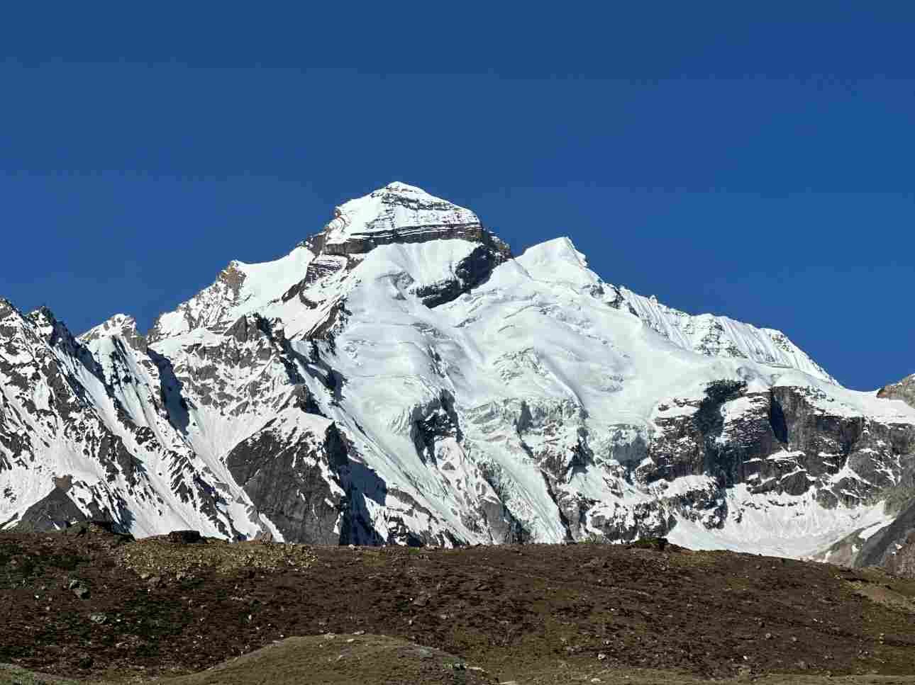
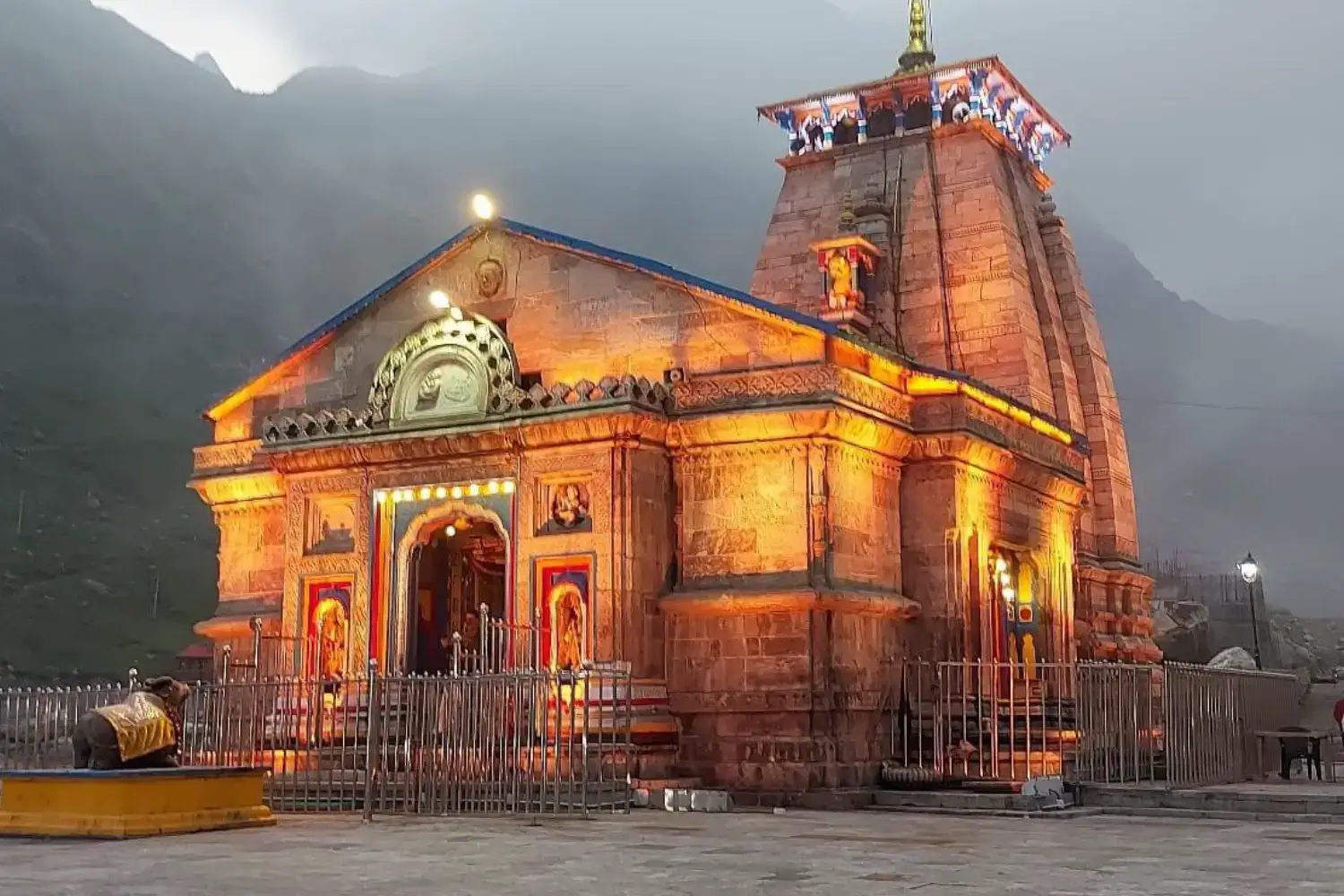
the arrival at Kedarnath temple — the sacred Jyotirlinga at 3,553 m with snow peaks all around — is the
kind of experience that makes the distance feel like exactly the right preparation for the darshan that
waits at the end of it.