Kailash Mansarovar Distance: Every Route, Every Kilometre, Every Starting Point
Planning a Kailash Mansarovar yatra has a way of making you realise how little you know about the
geography between where you are and where you want to go. You know Mount Kailash is in Tibet. You
know it is far. But how far, exactly? How far is it from Delhi to Kailash Mansarovar? Does the route go
through Uttarakhand or Nepal? What is the distance from Pithoragarh or Lipulekh Pass? If you are
coming from Kathmandu, what does that journey look like? And what happens to the distance
calculation once you cross the border into Tibet?
Most people searching for the kailash mansarovar distance get partial answers — a road distance here,
a flight time there, with the border crossing and the Tibet section often left vague. The result is that
pilgrims arrive at their departure city with an incomplete picture of the total journey and are genuinely
surprised by how long it takes to close the gap between their front door and the sacred shores of Lake
Mansarovar.
This guide gives you the complete kailash mansarovar distance from every major starting point in India
and Nepal — broken down stage by stage, with travel modes, approximate times, and the critical
geographic context that makes the numbers meaningful. Whether you are flying into Delhi, driving from
Pithoragarh, travelling through Nepal via Kathmandu, or asking about the distance from Kedarnath or
the Lipulekh Pass, every answer is here.
Kailash Mansarovar Distance: Understanding the Geography First
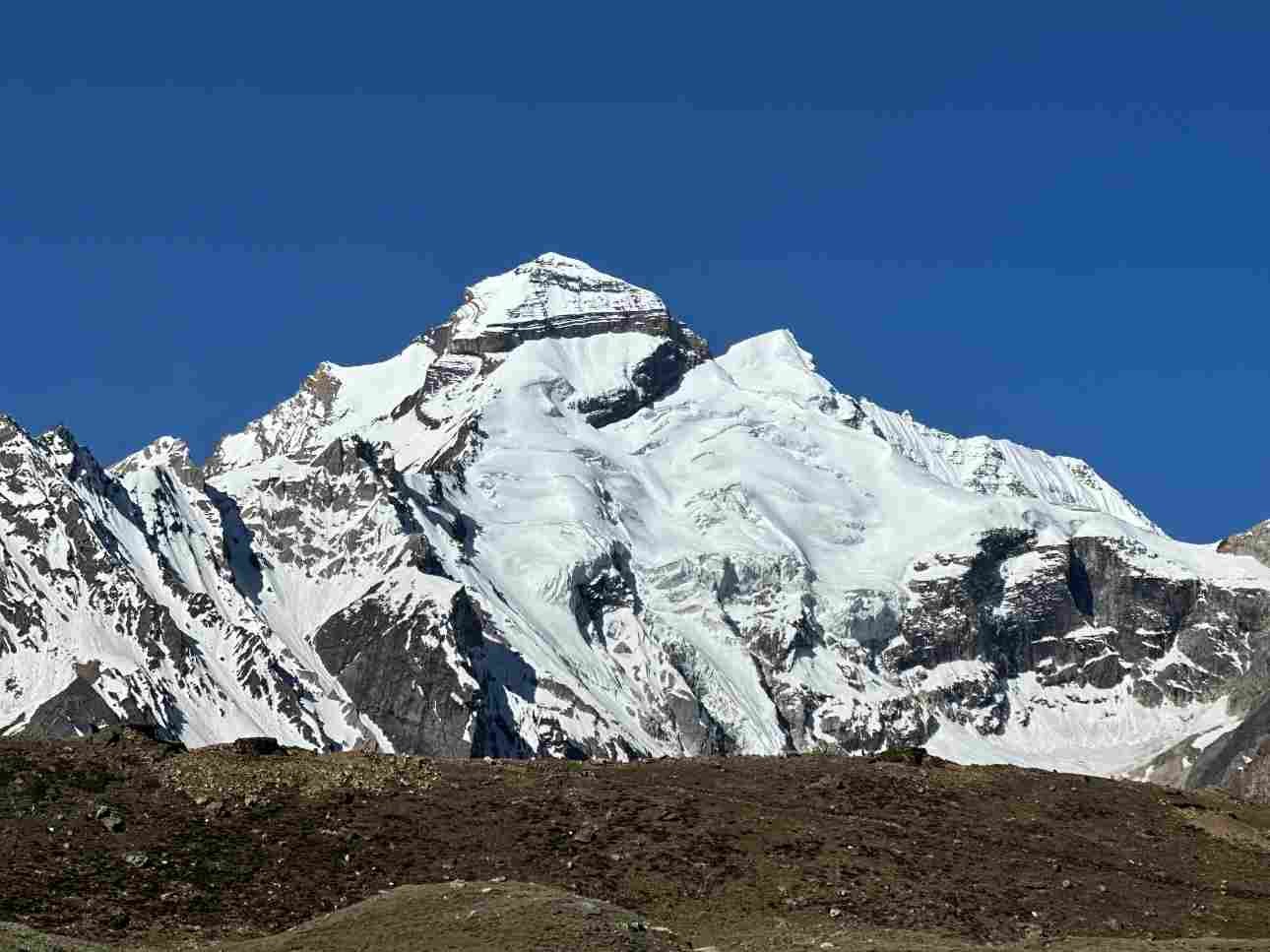
Before any distance number makes sense, the geography needs to be clear. Mount Kailash and Lake Mansarovar are located in the Ngari prefecture of the Tibet Autonomous Region of China — in the far
western corner of the Tibetan plateau, at one of the most remote accessible locations on Earth. The
mountain sits at 6,638 m and the lake at 4,590 m, approximately 30 km to the south of the mountain.
The nearest town of any size in Tibet is Darchen — the base camp village at the foot of Kailash — and
the road hub is Purang (also called Taklakot), approximately 35 km south of Darchen near the Nepal
border.
From India, the only land route to Kailash Mansarovar crosses into Tibet through the Lipulekh Pass in Uttarakhand — a border crossing at 5,334 m that is open only during the official yatra season (June to
September). From Nepal, the land route crosses into Tibet at Hilsa on the Nepal–Tibet border and
continues by road through Purang to Darchen. There is no route that approaches Kailash without
entering Tibet. The mansarovar distance from any Indian or Nepali starting point therefore always has
two distinct sections: the road distance to the border, and the Tibet section from the border to the lake
and mountain.

Delhi to Kailash Mansarovar Distance: The Most Searched Route
The delhi to kailash mansarovar distance is the single most searched distance query for this yatra —
and for good reason. Delhi is the primary departure point for the Uttarakhand route via Lipulekh Pass,
and it is also the starting city for most pilgrims taking connecting flights to Kathmandu for the Nepal
route. Getting the Delhi numbers right anchors everything else.
Delhi to Kailash Mansarovar via Uttarakhand (Lipulekh Pass Route)
The Uttarakhand route is the most culturally significant path for Indian pilgrims — the route blessed by
the Government of India and managed by the Ministry of External Affairs (MEA) through an annual
quota system. The delhi to mansarovar distance via this route breaks into clear segments. From Delhi to
Dehradun the road distance is approximately 300 km, taking 5 to 6 hours. From Dehradun to
Pithoragarh is approximately 260 km, taking 6 to 7 hours through the Kumaon hills. From Pithoragarh
the route continues to Dharchula, then Gunji, then Nabhidhang, and finally crosses the Lipulekh Pass at
5,334 m into Tibet.
The delhi to kailash parvat distance by road from Delhi to the Lipulekh border crossing is approximately
880 to 920 km. Inside Tibet, the road continues from the Lipulekh crossing to Taklakot (Purang) —
approximately 18 km — and then from Taklakot to Darchen base camp near Mount Kailash —
approximately 100 km. Lake Mansarovar is approximately 30 km before Darchen on this road. The total
delhi to kailash mansarovar distance via the Uttarakhand route, from Delhi city to the shores of Lake
Mansarovar, is approximately 1,020 to 1,050 km. The delhi to kailash parvat distance from Delhi all the
way to the Darchen base camp at the foot of the mountain is approximately 1,050 to 1,080 km.
Delhi to Kailash Mansarovar via Nepal (Kathmandu Route)
Pilgrims choosing the Nepal route typically fly from Delhi to Kathmandu — a flight of approximately 1.5
hours covering approximately 1,150 km by air. From Kathmandu, the route continues by road and/or
flight to the Nepal–Tibet border. The delhi to mansarovar distance via this combined air and road route
is greater in geographic distance but significantly faster in travel time for the India-to-Nepal section. The
full delhi to kailash mansarovar distance via Nepal including the Kathmandu to Mansarovar section is
approximately 1,400 to 1,500 km by combined air and road.
Kailash Mansarovar Distance: Complete Reference from Every
Starting Point
This master table captures the kailash mansarovar distance from every major starting point — inside
India, from Nepal, and the Tibet section itself. Use it as your planning reference for the complete
journey.
| Start → Destination | Route Type | Time |
| Delhi → Lipulekh | Road | 5–6 days |
| Delhi → Mansarovar (Lipulekh) | Road + Tibet | 7–9 days |
| Delhi → Kathmandu | Flight | ~1.5 hrs |
| Pithoragarh → Mansarovar | Road + Tibet | 5–6 days |
| Lipulekh → Mansarovar | Tibet road | 3–4 hrs |
| Kathmandu → Mansarovar | Flight + Road | 4–5 days |
| Hilsa → Mansarovar | Tibet road | 2–3 hrs |
| Kedarnath → Kailash (Darchen) | Road | 6–8 days |
| Darchen → Mansarovar | Road | 45–60 min |
Uttarakhand to Kailash Mansarovar Distance: The Indian Land Route
The uttarakhand to kailash mansarovar distance is the total road journey from the Uttarakhand border
with Tibet — crossed at the lipulekh pass — to the shores of Lake Mansarovar. This route is the only
land route available to Indian nationals and is managed by the MEA in partnership with the Kumaon
Mandal Vikas Nigam (KMVN). It is also the route with the deepest historical and spiritual resonance for
Indian pilgrims — the same path walked by saints and traders on the ancient Silk Road for centuries.
The uttarakhand to kailash mansarovar distance journey begins in Delhi or Dehradun and progresses
through the Kumaon Himalayas in carefully managed stages. The route from Dehradun to the Lipulekh
Pass covers approximately 580 to 600 km by road over five to six days of driving and acclimatisation
stops. Key staging points are Pithoragarh (overnight halt), Dharchula (1 to 2 nights for permits and
acclimatisation), Gunji (overnight), Nabhidhang (overnight), and then the Lipulekh Pass crossing into
Tibet. The slow pace of this road journey is deliberate — the altitude gains are significant and rushing
this section leads directly to altitude sickness.
Pithoragarh to Kailash Mansarovar Distance
Pithoragarh is the last major town before the high-altitude stages of the Uttarakhand route and is where
most pilgrims spend their first proper acclimatisation night in the Kumaon hills. The pithoragarh to
kailash mansarovar distance from the town centre to Lake Mansarovar is approximately 340 to 360 km
— covering the remaining road stages to Dharchula (approximately 90 km), Dharchula to Gunji
(approximately 80 km), Gunji to Nabhidhang (approximately 20 km), Nabhidhang to Lipulekh Pass
(approximately 8 km), and then the Tibet section from Lipulekh to Taklakot (approximately 18 km) and
Taklakot to Lake Mansarovar (approximately 100 km).
Pithoragarh itself sits at 1,814 m. By the time you reach Nabhidhang — the last Indian camp before the
Lipulekh Pass — you are at 3,600 m. The pithoragarh to kailash mansarovar distance therefore involves
not just road kilometres but a massive altitude gain that shapes every decision about pace, rest, and
preparation. Most yatra itineraries spend two nights in Pithoragarh specifically to allow this altitude
adjustment to begin properly.
Lipulekh Pass to Kailash Mansarovar Distance
The lipulekh pass to kailash mansarovar distance is the Tibet section of the journey — the kilometres
that begin the moment you cross the border at 5,334 m and start descending into the Tibetan plateau.
From the Lipulekh Pass, the road descends to Taklakot (Purang) — approximately 18 km — where all
pilgrims complete Tibet immigration formalities. From Taklakot, the road continues north along the
Karnali River valley for approximately 80 km to Mansarovar Lake, and then a further 30 km around the
lake shore to Darchen at the base of Mount Kailash.
The total lipulekh pass to kailash mansarovar distance is therefore approximately 100 to 110 km inside
Tibet. This section is covered by bus or jeep on Tibetan roads and takes approximately 3 to 4 hours in
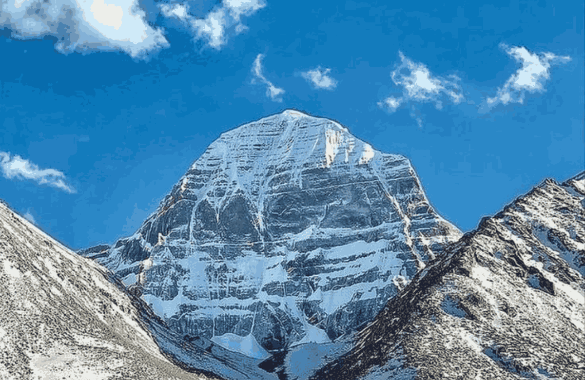
good conditions. The landscape on this drive — the vast open Tibetan plateau suddenly revealing the
pyramid of Kailash on the northern horizon — is one of the most visually extraordinary moments of the
entire yatra. Most pilgrims describe seeing the mountain for the first time from this road as a moment
that stops conversation entirely.
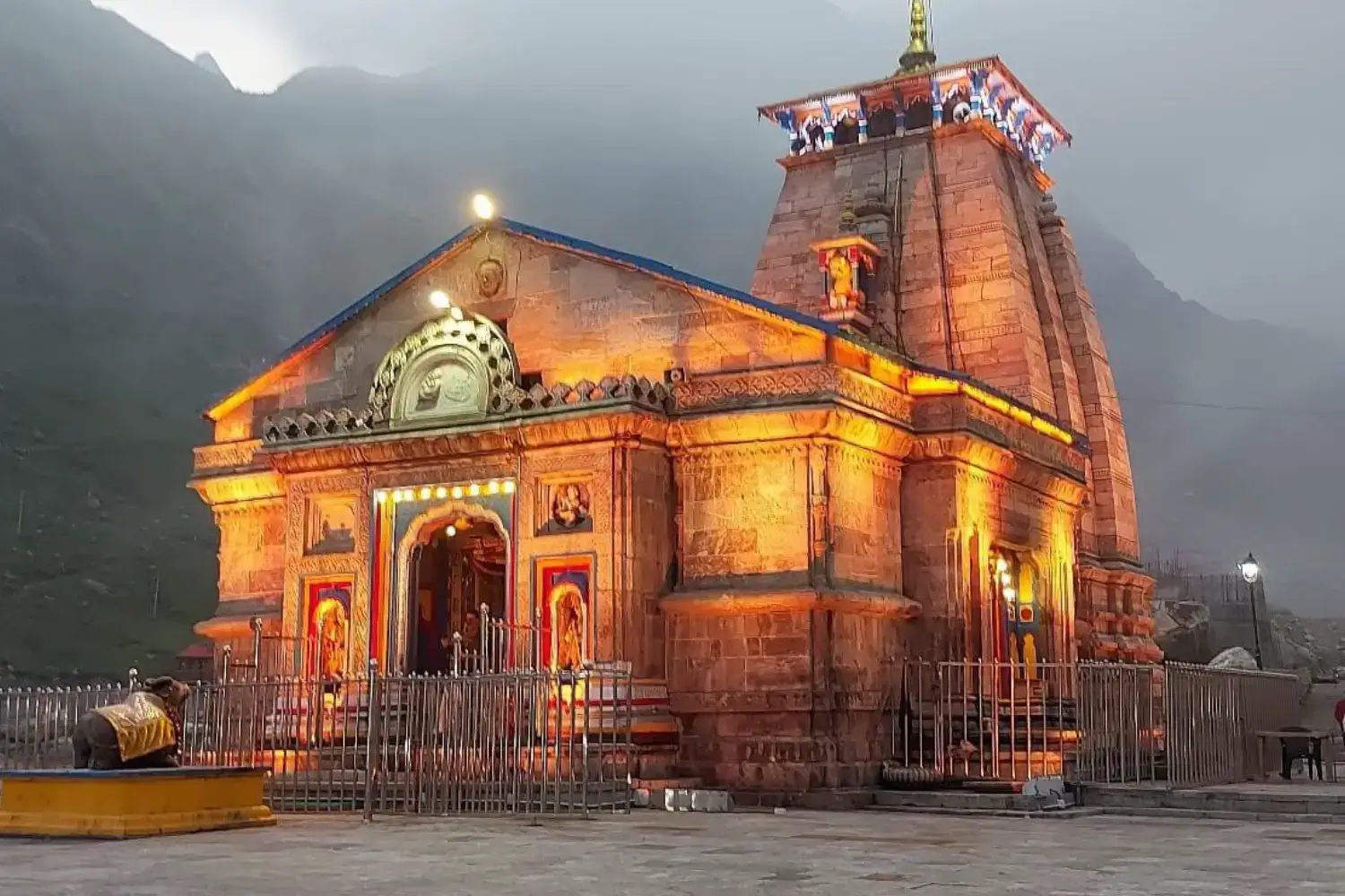
Kedarnath to Kailash Mansarovar Distance: Two Sacred Mountains,One Journey
Kedarnath and Mount Kailash are both deeply sacred to Lord Shiva — Kedarnath being the earthly
temple in the Garhwal Himalayas, and Kailash being the divine abode in Tibet. Many pilgrims dream of
completing both pilgrimages in a single trip, which makes the kedarnath to kailash mansarovar distance
a question with real practical significance.
The honest answer about the kedarnath to kailash parvat distance requires some geographic context.
Kedarnath and Mount Kailash are separated by approximately 350 km in a straight line across the
Himalayas. But there is no direct road connection between them. The entire Himalayan range lies
between the two sites. Any road journey from Kedarnath to Kailash Mansarovar must first descend from
the Garhwal Himalayas to the plains, travel east to Pithoragarh in Kumaon, and then climb back up
through the Uttarakhand route to the Lipulekh Pass.
The kedarnath to kailash mansarovar distance by road — descending from Kedarnath to Rishikesh or
Haridwar, then travelling east to Pithoragarh and onward via the Uttarakhand yatra route — is
approximately 900 to 950 km. In terms of total journey time, a combined Kedarnath and Kailash
Mansarovar pilgrimage in a single trip takes a minimum of 18 to 22 days. Many pilgrims who wish to
complete both choose to do them in separate years rather than compressing the journey. Combined
packages are available for those with the time and fitness to do both.
Kathmandu to Kailash Mansarovar Distance: The Nepal Route
The Nepal route to Kailash Mansarovar is the preferred option for international pilgrims and for those
who want a shorter overall travel time between their home country and the sacred site. Understanding
the kathmandu to kailash mansarovar distance is therefore essential for anyone planning the nepal to
kailash mansarovar route.
From Kathmandu, the Nepal route to Kailash Mansarovar uses a combination of domestic flights and
road travel. The first segment is a flight from Kathmandu to Nepalgunj (approximately 1.5 hours),
followed by a second domestic flight from Nepalgunj to Simikot (approximately 1 hour) — a remote
airstrip in the Humla district of far-western Nepal. From Simikot, pilgrims trek or take a helicopter to
Hilsa on the Nepal–Tibet border — the Simikot to Hilsa trek covers approximately 100 km and takes 4 to
5 days on foot, or 30 to 40 minutes by helicopter.
At Hilsa, pilgrims cross into Tibet and board vehicles for the final Tibet section. From Hilsa to Purang
(Taklakot) is approximately 30 km. From Purang to Lake Mansarovar is approximately 55 to 60 km. The
total kathmandu to kailash mansarovar distance by this combined flight and road route is approximately
900 to 1,000 km. The nepal to kailash mansarovar distance from the Nepal–Tibet border at Hilsa to the
shores of Lake Mansarovar is approximately 80 to 90 km inside Tibet.
Why Many Pilgrims Choose the Nepal Route
- Significantly less trekking — the Nepal route involves much more flight-based and road-based
travel compared to the long overland stages of the Uttarakhand route.
- No MEA quota restrictions — Indian nationals can use the Nepal route without entering the
Government of India's Kailash Mansarovar yatra quota system.
- Faster overall travel time — the kathmandu to kailash mansarovar distance by combined flight and
road can be covered in 4 to 5 days compared to 6 to 8 days on the Uttarakhand overland route.
- Better suited for older pilgrims and those with limited fitness — less walking distance means
altitude acclimatisation is managed through rest stops rather than physical trekking.
- Available through private tour operators from multiple countries — the Nepal route can be booked
by pilgrims from any nationality without needing Indian government sponsorship.
Kailash Mansarovar Distance: Uttarakhand vs Nepal Route Compared
The two official routes to Kailash Mansarovar have very different distance profiles. Here is a
stage-by-stage comparison of the kailash mansarovar distance on both routes so you can understand
exactly what you are committing to on each path.
| Stage | Uttarakhand Route (Lipulekh) | Nepal Route (Simikot–Hilsa) |
| 1 | Delhi → Dehradun (300 km, 5–6 hrs) | Delhi → Kathmandu (Flight, 1.5 hrs) |
| 2 | Dehradun → Pithoragarh (260 km, 6–7 hrs) | Kathmandu → Nepalgunj (Flight, 1.5 hrs) |
| 3 | Pithoragarh → Gunji/Nabhidhang (~190 km, 2–3 days) | Nepalgunj → Simikot (Flight, 1 hr); Simikot → Hilsa (Trek 4–5 days / Heli 40 min) |
| 4 | Nabhidhang → Lipulekh (8 km trek, 3–4 hrs); Lipulekh → Taklakot (road, 1 hr) | Hilsa → Purang (30 km, 1 hr) |
| 5 | Taklakot → Mansarovar (100 km, 3–4 hrs) | Purang → Mansarovar (55–60 km, 1.5–2 hrs) |
| 6 | Mansarovar → Darchen (30 km, 45 min) | Mansarovar → Darchen (30 km, 45 min) |
| Kora | Darchen → Kailash Kora (52 km, 3 days) | Darchen → Kailash Kora (52 km, 3 days) |
| Total | 22–28 days | 14–21 days |
Mansarovar Distance: The Lake and Its Relationship to the Mountain
Understanding the mansarovar distance within the Tibet section helps pilgrims plan the on-ground days
once they have crossed the border. Lake Mansarovar and Mount Kailash are not at the same location
— they are approximately 30 km apart by road, with Mansarovar sitting to the south of the mountain and
Darchen base camp sitting at the mountain's foot on its south face.
Most kailash mansarovar yatra itineraries spend two to three days at and around Lake Mansarovar
before proceeding to Darchen for the Kora. The lake itself is 88 km in circumference — a full Parikrama
(circumambulation) of Mansarovar is 90 km and takes three days, though most pilgrims complete only a
partial circuit of the shore due to time constraints. The lake sits at 4,590 m and is crystal clear — the
colour of deep sapphire against the brown Tibetan plateau. Even from the road approaching it for the
first time, the sight of Mansarovar takes your breath away in a way that has nothing to do with altitude.
From Mansarovar it is 30 km by road to Darchen — the base camp for the Kora. The Kora itself is a 52
km circumambulation around the base of Mount Kailash, typically completed over three days with
camps at Dira Puk (north face camp) and Dzutrulpuk (east face camp). The highest point of the Kora is
the Dolma La pass at 5,630 m — the most physically demanding section of the entire kailash
mansarovar distance journey.
Inside Tibet: Understanding the Final Section of the Kailash
Mansarovar Distance
Once you cross the Tibet border — whether at Lipulekh from India or at Hilsa from Nepal — the
remaining distance to Kailash Mansarovar is inside the Tibet Autonomous Region of China. This section
is covered entirely by road in vehicles arranged by your licensed Tibetan tour operator. Individual travel
is not permitted in the Ngari prefecture of Tibet — all pilgrims must be part of a licensed group tour with
a Tibetan guide.
The roads inside Tibet are generally well-maintained on the main route between Taklakot (Purang),
Mansarovar, and Darchen. The terrain is the high Tibetan plateau — vast, flat, open, and at altitudes
between 4,500 m and 5,000 m throughout. The landscape is simultaneously one of the most austere
and most magnificent environments on Earth. Many pilgrims describe the drive through Tibet to the
mountain as a journey through another world entirely — the sky a different shade of blue, the silence a
different quality of quiet, the mountains appearing in the distance with an unusual clarity.

Key Distance Points Inside Tibet
- Lipulekh Pass (India–Tibet border) to Taklakot (Purang): approximately 18 km, 45 minutes to 1
hour by road.
- Hilsa (Nepal–Tibet border) to Taklakot (Purang): approximately 30 km, 1 hour by road.
- Taklakot (Purang) to Lake Mansarovar: approximately 80 to 100 km, 2 to 3 hours by road — the
exact distance depends on the specific road taken and the entry point to the lake.
- Lake Mansarovar to Darchen (Kailash base camp): approximately 30 km, 45 minutes to 1 hour by
road.
- Darchen to Dira Puk (Day 1 Kora camp, north face): approximately 19 to 20 km on foot, 6 to 7
hours.
- Dira Puk to Dzutrulpuk (Day 2 Kora camp, via Dolma La at 5,630 m): approximately 22 km on foot,
8 to 9 hours including the Dolma La crossing.
- Dzutrulpuk to Darchen (Day 3 Kora return): approximately 10 to 11 km on foot, 4 to 5 hours.
Preparing for the Kailash Mansarovar Distance: What the Journey Actually Demands
The kailash mansarovar distance numbers are, in one sense, just numbers. In another sense, they
represent one of the most physically and logistically demanding journeys any pilgrim can undertake.
The altitude alone — spending days at 4,500 m to 5,630 m — places real demands on the human body.
Understanding what the distance actually requires in terms of preparation is as important as knowing
the kilometres themselves.
Physical Preparation
- Begin cardiovascular training 3 to 6 months before departure — sustained aerobic exercise builds
the lung capacity needed for high altitude
- Include high-altitude training if possible — a trek to Kedarnath, Hemkund Sahib, or similar 4,000
m-plus destinations prepares your body in ways that gym training cannot replicate.
- A medical check-up including ECG, blood pressure, and lung function assessment is required by all
serious yatra operators and strongly recommended regardless.
- Do not underestimate the Kora — 52 km over three days at altitudes between 4,575 m and 5,630 m
is genuinely demanding even for fit adults. The Dolma La crossing in particular requires real reserves
of energy
Acclimatisation Along the Route
One of the most important aspects of the kailash mansarovar distance is that it cannot be rushed. The
slow pace of the Uttarakhand overland route — with its multiple overnight halts at increasing altitudes
from Pithoragarh through Dharchula to Gunji and Nabhidhang — is not bureaucratic inefficiency. It is the
acclimatisation schedule that keeps pilgrims safe. Each halt gives the body time to produce more red
blood cells, adjust its breathing patterns, and adapt to the reduced oxygen. Pilgrims who try to compress
the schedule, or who arrive at the Lipulekh Pass without adequate acclimatisation days, are the ones
most likely to develop altitude sickness in Tibet.
On the Nepal route, acclimatisation is managed through strategically placed rest days at Simikot and
Hilsa before the Tibet section begins. Do not skip these rest days regardless of how good you feel —
the ability to walk from your tent to the toilet feeling fine is not the same as being ready to cross a 5,630
m mountain pass three days later.
Documents and Permits
- Tibet Travel Permit — mandatory for all foreign nationals in Tibet, including Indian nationals.
Handled by your licensed operator.
- Inner Tibet Permit (Aliens' Travel Permit for Ngari Region) — required specifically for the Kailash
Mansarovar area. Also handled by operator.
- For the Uttarakhand route: MEA registration through the Indian government's official Kailash
Mansarovar Yatra portal.
- Valid passport with minimum 6 months validity. Chinese visa is not required for most Indian
nationals on the official MEA-sponsored yatra.
- Compulsory health/medical certificate — most operators require this before accepting booking.
Conclusion
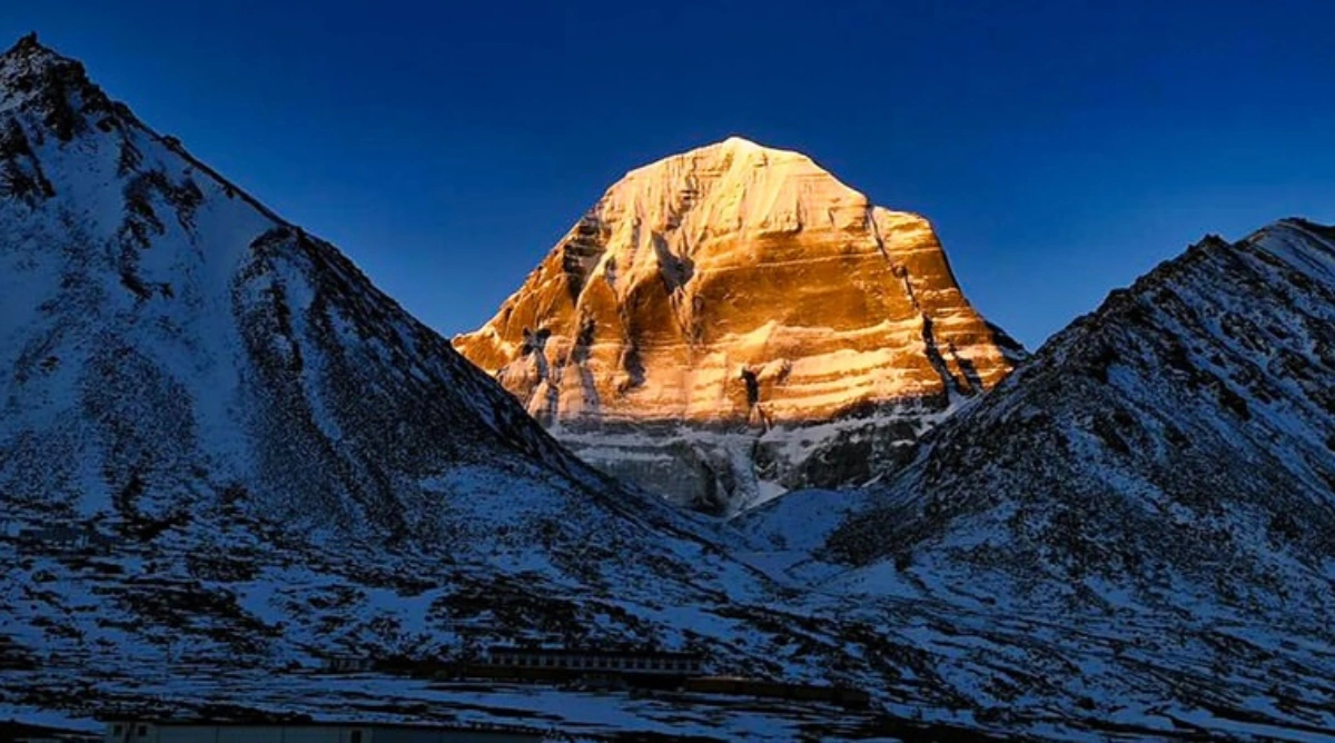
The kailash mansarovar distance is not a single number — it is a layered journey that begins at your
front door and ends, if you are fortunate, on the shores of Lake Mansarovar with the south face of Mount
Kailash reflected in its waters. From Delhi, that journey covers over 1,000 km by road through the
Kumaon Himalayas and the Tibetan plateau. From Kathmandu, it covers 900 to 1,000 km by flight and
road through Nepal and into Tibet. From Kedarnath, it means first descending to the plains before
climbing again through an entirely different range of mountains.
Every one of those kilometres serves a purpose. The slow overland approach through Uttarakhand
acclimatises your body stage by stage. The vast Tibetan plateau gives your mind time to decompress
from the urgency of ordinary life. And by the time you reach Darchen and the great black pyramid of
Kailash fills your entire field of vision — the distance between where you started and where you are
standing will feel like the most meaningful distance you have ever travelled.