Amarnath Yatra Route: Your Complete Guide to Every Stage of the Sacred Journey
Planning the Amarnath yatra is one of those things that sounds straightforward until you actually try to
do it. Which route should you take — Pahalgam or Baltal? How far is it really from Srinagar to
Amarnath? What is the role of Sonamarg and Baltal in the journey? Which is the nearest railway station
to Amarnath? What does the amarnath yatra route map actually look like on the ground? Most first-time
pilgrims spend days bouncing between conflicting answers and still arrive at the trailhead unsure of
what the next three days will look like.
This guide solves all of that in one place. Whether you are coming from Delhi, Mumbai, Srinagar, or
anywhere else in India, every stage of the amarnath yatra route is laid out here clearly — the distances
in km, the landmarks, the road sections, the trek stages, the altitude gains, and the practical decisions
you need to make before you go. Read this once and you will be ready to plan your yatra with complete
confidence.
Amarnath Yatra Route: Understanding the Full Journey
The Amarnath yatra does not work the way most pilgrimages do. You cannot simply book a ticket and
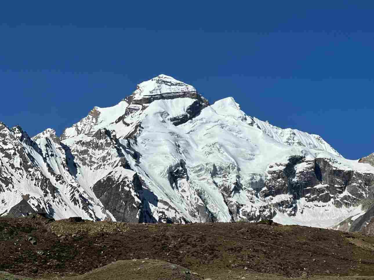
arrive at the shrine. The Holy Cave of Amarnath — where the sacred ice Shivling forms naturally inside
a mountain cave at 3,888 metres above sea level — sits deep in the Himalayan wilderness of Jammu
and Kashmir, accessible only on foot or by helicopter. Every pilgrim must travel in stages: first by road to
a base camp, then on foot through high-altitude terrain to the cave.
There are two official amarnath yatra routes, each with its own base camp, trek distance, difficulty
profile, and character. The Pahalgam route is the traditional, historically significant path — longer, more
gradual, and spread across three to four days of trekking. The Baltal route is the modern alternative —
shorter, steeper, and completed as a single very demanding day. Understanding the difference between
these two routes is the single most important planning decision of your yatra.
Both routes begin from Srinagar — the nearest major city and the primary air and road hub for the
amarnath yatra — and both pass through stunning Kashmiri mountain scenery before reaching the
cave. The amarnath yatra route map shows two distinct paths converging at the Sangam junction near
the cave, where pilgrims from both base camps merge for the final approach.
Srinagar to Amarnath: The Gateway to the Yatra
Srinagar is where the amarnath yatra practically begins for most pilgrims arriving by air. Sheikh ul-Alam
International Airport connects Srinagar to Delhi, Mumbai, Bangalore, and several other major Indian
cities with daily flights. From Srinagar, pilgrims travel by road to their chosen base camp — either
Pahalgam or Baltal — before beginning the trek to the cave.
The srinagar to amarnath distance depends entirely on which base camp you choose. Via Pahalgam,
the road distance from Srinagar is approximately 96 km, taking 2.5 to 3 hours by road. Via Baltal, the
srinagar to amarnath distance by road is approximately 93 km, taking 2 to 2.5 hours. These distances
cover the road section only — the actual srinagar to amarnath yatra distance including the trek to the
cave is significantly greater and depends on which route you take.
Most pilgrims arriving by flight spend one night in Srinagar before proceeding to the base camps. This is
genuinely good practice — not just for logistics, but for acclimatisation. Srinagar sits at 1,585 metres
and giving your body a night at this altitude before climbing toward 3,888 metres makes a measurable
difference to how you perform on the trail. Many kailash yatra operators and individual pilgrims alike
build a Srinagar night into their schedule for exactly this reason
Srinagar to Pahalgam: The Road to the Traditional Base Camp
The drive from Srinagar to Pahalgam follows National Highway 44 south through Anantnag before
turning east into the Lidder Valley. The 96 km road journey takes 2.5 to 3 hours in normal conditions
and passes through some of the most beautiful valley scenery in Kashmir — apple orchards,
willow-lined rivers, and the gradual rise of the mountains as you approach Pahalgam. The road is
well-maintained for most of the route, with some narrow sections as you enter the Lidder Valley near
Pahalgam town.
Pahalgam town itself sits at 2,130 metres and is a well-developed tourist destination with good hotels,
restaurants, and facilities. Pilgrims typically base themselves here for a night before beginning the trek
the following morning. The SASB registration camp and pony booking counters are at the Nunwan base
camp just outside Pahalgam town — this is where the trek officially begins.
Srinagar to Baltal: The Road to the Shorter Route
The drive from Srinagar to Baltal follows the Srinagar–Leh National Highway northeast through
Ganderbal toward Sonamarg. The 93 km journey takes 2 to 2.5 hours on what is one of the most scenic
highways in India — the road climbs steadily through pine forests and river valleys before reaching the
open meadows of Sonamarg at 2,730 metres. From Sonamarg, the sonmarg to baltal distance is
approximately 16 km along the same highway, taking about 30 to 40 minutes by road.
Baltal itself is a sparse base camp rather than a town — a flat valley at 2,743 metres with tent
accommodations, basic dhabas, medical facilities, and the SASB camp registration point. There is no
hotel-level accommodation at Baltal. Pilgrims who arrive late should plan to stay in Sonamarg the night
before and proceed to Baltal early the following morning.
Amarnath Yatra Route Map: Two Routes Side by Side
The most important planning decision of your amarnath yatra is choosing between the Pahalgam and
Baltal routes. They lead to the same holy cave but offer entirely different journeys. Here is a clear,
honest comparison of both routes so you can make the right call for your fitness, time, and experience
level.Trek distance plays a major role when choosing your route.
| Feature | Pahalgam Route (Traditional) | Baltal Route (Shorter) |
| Base Camp | Pahalgam / Nunwan (2130 m) | Baltal (2743 m) |
| Trek Distance | 36–48 km (one way) | 14–16 km (one way) |
| Duration | 3–4 days | 1 day |
| Key Stages | Pahalgam → Chandanwari → Sheshnag → Panjtarni → Cave | Baltal → Domel → Barari → Sangam → Cave |
| Difficulty | Moderate, gradual ascent | Strenuous, steep |
| Highest Point | Mahagunas Pass (4600 m) | Cave (3888 m) |
| Best For | Families, elderly, first-timers | Fit, time-limited trekkers |
| Helicopter | Neelgrath → Panjtarni | Baltal → Panjtarni |
| Srinagar Distance | ~96 km (2.5–3 hrs) | ~93 km (2–2.5 hrs) |
Amarnath Yatra Route via Pahalgam: Stage by Stage
The Pahalgam route is the traditional amarnath yatra route — the path that pilgrims have walked for
centuries. It is longer than the Baltal alternative but the gradual ascent, the iconic Himalayan
landscapes, and the multi-day immersion in the pilgrimage atmosphere make it the recommended
choice for most first-time yatris. The amarnath yatra route km from Pahalgam to the Holy Cave ranges
from 36 to 48 km depending on the sub-route and is spread across three to four days.
Stage 1 — Pahalgam to Chandanwari: 16 km
The first stage begins at Nunwan base camp just outside Pahalgam town and follows the Lidder River
upstream through a gradually narrowing valley. This is the most accessible section of the entire
amarnath yatra route — wide, well-marked, and gently graded for the first several kilometres. The
terrain shifts from meadow to pine forest to rocky valley as you approach Chandanwari at 2,895 m. This
stage takes 5 to 6 hours for an average pilgrim at a steady pace. Chandanwari is where the famous
snow bridge — a natural formation across the Lidder River — is traditionally crossed at the start of the
season. Tent accommodation and dhaba facilities are available at Chandanwari.
Stage 2 — Chandanwari to Sheshnag: 13 km
This is the most visually dramatic stage of the Pahalgam amarnath yatra route. The trail climbs steeply
from Chandanwari through the Pisu Ghati — a high ridge that offers the first sweeping panoramic views
of the yatra — before descending to the shores of Sheshnag Lake at 3,590 m. Sheshnag is one of the
most breathtaking sights of the entire journey: a deep glacial lake of stunning cobalt blue, named for the
mythical serpent king Sheshnag who is believed to inhabit its depths. The 13 km stage takes 5 to 6
hours and includes the hardest sustained climbing of the Pahalgam route. Accommodation at Sheshnag
is in tents — bring warm layers.
Stage 3 — Sheshnag to Panjtarni: 12 km
The third stage is the highest and most altitude-demanding section of the Pahalgam amarnath yatra
route. The trail climbs from Sheshnag at 3,590 m to the Mahagunas Pass at 4,600 m — the highest
point of the entire yatra — before descending to the broad meadows of Panjtarni at 3,657 m. The
Mahagunas crossing is where altitude effects are felt most strongly. Move slowly, drink water regularly,
and do not try to rush this section regardless of how you feel at the start of the day. The descent to
Panjtarni is long but rewarding — the meadow is wide, flat, and peaceful, and the sense of having
crossed the hardest section of the route settles over most pilgrims here.
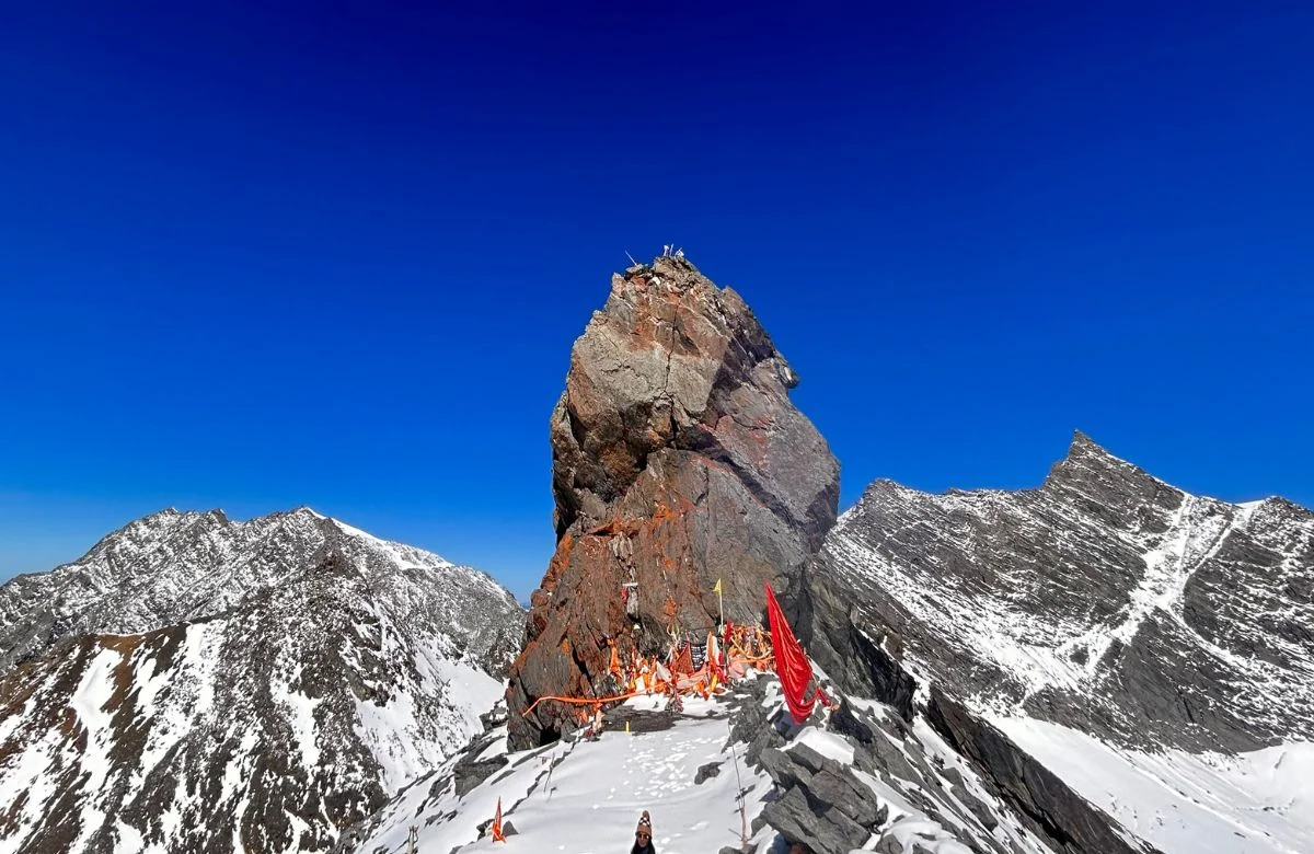
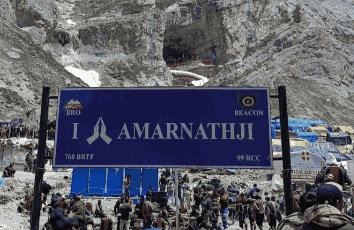
Stage 4 — Panjtarni to the Holy Cave: 6 km
The final 6 km from Panjtarni to the Holy Cave is the most spiritually charged section of the entire
journey. The trail narrows as it enters the gorge leading to the cave, and the sound of conch shells and
devotional chanting begins to fill the air from other pilgrims ahead. The cave itself sits at 3,888 m — a
naturally formed hollow in the mountain where the sacred ice Shivling, the ice stalagmite representing
Lord Shiva, forms each year during the summer months. The size of the Shivling fluctuates with the
lunar calendar, reaching its peak on Shravan Purnima. Darshan queues at the cave can range from 30
minutes to several hours depending on the season and day. Ponies and dandis are available on the
Panjtarni to cave section.

Amarnath Yatra Route via Baltal: The Shorter Path
The Baltal amarnath yatra route is the modern alternative — developed to give pilgrims with limited time
a feasible way to complete the darshan in a single day. At 14 to 16 km one way, it is less than half the
distance of the Pahalgam route. But that shorter amarnath yatra route km comes at a significant
physical cost: the Baltal trail is steep and unrelenting from the very first step, and the speed of ascent
from 2,743 m to 3,888 m in a single day is what makes it demanding even for fit adults. If you're short on time, the Amarnath Yatra by Road via Baltal follows the faster Baltal route and is ideal for pilgrims looking for a shorter itinerary.
Baltal to Domel:
4 km
The Baltal route begins at the base camp with an immediate steep climb out of the valley. The first 4 km
to Domel at 2,987 m offer no warm-up — the trail rises sharply from the first step. The path follows the
Baltal River gorge through dramatic rocky terrain. Most trekkers complete this section in 1.5 to 2 hours.
Domel is a small halt point with basic facilities and a medical camp,
Domel to Sangam:
8 km
From Domel the trail continues to ascend steeply through Barari at 3,505 m and onward to Sangam at
3,657 m — the junction point where the Baltal trail meets the descending path from the Pahalgam route.
This 8 km section is the hardest of the Baltal amarnath yatra route. The climb from 2,987 m to 3,657 m
is relentless and the reduced oxygen at this altitude makes every step feel heavier than it should. Take
your time, breathe deliberately, and drink water consistently. The total time from Domel to Sangam is
typically 4 to 5 hours for an average pilgrim.
Sangam to Holy Cave:
2 to 4 km
From Sangam, the final approach to the Holy Cave follows the same gorge path used by Pahalgam
route pilgrims descending after darshan. The distance from Sangam to the cave is 2 to 4 km depending
on the precise sub-route. The gradient eases slightly here after the sustained steep climbing of the
lower sections. Most trekkers reach the cave from Baltal in a total of 5 to 7 hours from the base camp.
The return journey to Baltal takes 3 to 4 hours on the descent — complete the darshan, rest at the cave,
and descend steadily to arrive back at Baltal before dark.

Sonamarg to Amarnath: The Gateway Town for the Baltal Route
Sonamarg — the 'Meadow of Gold' — is the last significant town on the Srinagar–Leh highway before
the Baltal base camp and plays a key practical role in the Baltal amarnath yatra route. Sitting at 2,730
m, Sonamarg is where most pilgrims taking the Baltal route spend the night before proceeding to the
base camp early the following morning.
The sonmarg to amarnath distance via Baltal is approximately 30 km total — 16 km by road from
Sonamarg to Baltal base camp, and 14 to 16 km on foot from Baltal to the Holy Cave. The sonmarg to
baltal distance of 16 km takes approximately 30 to 40 minutes by road and is covered by shared taxis,
private cabs, and SASB buses during the yatra season. Sonamarg has good hotel accommodation
ranging from budget to mid-range, making it the most comfortable overnight stop for pilgrims taking the
Baltal route. Book Sonamarg accommodation well in advance during the yatra season as rooms fill up
fast.
Beyond its practical role, Sonamarg is worth spending time in even outside the yatra context. The
Thajiwas Glacier, accessible by a short pony ride from the town, offers a dramatic close-up of
Himalayan glacial ice. The meadows above the town are among the most beautiful in Kashmir. Many
pilgrims arrive in Sonamarg a day early specifically to acclimatise and appreciate the landscape before
the demanding trek to the cave.
Amarnath Nearest Railway Station: Getting to the Yatra by Train
For the millions of pilgrims who travel by train to reach the amarnath yatra, understanding the rail
connectivity to the region is essential. The amarnath nearest railway station is Jammu Tawi — the
railhead of Jammu city and the most important transit point for the yatra from all parts of India.
Jammu Tawi is located approximately 315 km from Pahalgam base camp by road and approximately
330 km from Baltal base camp. The road journey from Jammu to Pahalgam takes 6 to 7 hours. From
Jammu to Baltal via Srinagar the journey takes 8 to 9 hours. The amarnath near railway station
connectivity at Jammu Tawi is excellent — it is one of the best-connected rail junctions in northern India,
with direct trains from Delhi, Mumbai, Kolkata, Bangalore, and virtually every major city in the country.
Key Trains from Delhi to Jammu Tawi
The Jammu Rajdhani Express (Train No. 12425) is the fastest and most popular option — departing
New Delhi at 20:35 and reaching Jammu Tawi by approximately 05:50 the next morning, a journey of
about 9 hours 15 minutes. The Uttar Sampark Kranti Express (12471) departs Hazrat Nizamuddin at
20:30 and reaches Jammu by 06:00. The Jammu Mail (14033) from Old Delhi and the Shalimar Express
(14645) from New Delhi are also reliable overnight options. Book at least 60 days in advance for the
yatra season — berths sell out fast in June and July
From Jammu Tawi to the Base Camps
- From Jammu Tawi station, take a cab or JKSRTC bus from the Jammu Bus Stand (adjacent to the
station) to Pahalgam or Baltal.
- Jammu to Pahalgam: approximately 315 km, 6 to 7 hours by road via Udhampur, Ramban, Banihal
Tunnel, and Anantnag.
- Jammu to Baltal: approximately 330 km, 8 to 9 hours by road via the Jammu–Srinagar National
Highway and onward to Sonamarg.
- Shared jeeps and private cabs are available outside Jammu Tawi station — private cabs can be
pre-booked online for convenience.
- JKSRTC operates direct buses to Srinagar from Jammu Bus Stand throughout the day — from
Srinagar you can connect onward to either base camp.
- Plan an overnight halt at Jammu if you arrive by a late-night train — attempting the full drive to the
base camp on the same day is exhausting and inadvisable.
Is There a Closer Railway Station?
The question of the amarnath near railway station often comes up in the context of whether Udhampur
or Katra (near Vaishno Devi) might be more convenient alternatives. Udhampur railway station is
approximately 270 km from Pahalgam — closer than Jammu Tawi by road distance but with significantly
fewer train connections. Katra railway station serves Vaishno Devi pilgrims primarily and has limited
connectivity for Amarnath-bound travellers. For practical purposes, Jammu Tawi remains the best and
most convenient amarnath nearest railway station for pilgrims arriving from any part of India.
SASB Registration: What You Must Do Before the Yatra
Before you plan any part of your amarnath yatra route — before you book your train ticket, before you
reserve a hotel in Srinagar, before you arrange transport to the base camp — register with the Shri
Amarnathji Shrine Board. Registration is mandatory. Without it, you will be turned back at the first
checkpoint regardless of how far you have travelled to get there.
- Register online at www.shriamarnathjishrine.com — registration typically opens in April or May for
the upcoming season.
- Obtain a Compulsory Health Certificate (CHC) from a doctor designated by SASB — a list of
authorised doctors is available on the SASB website.
- Registration is free. Any website charging a fee for SASB registration is a third-party service, not
the official process.
- Your registration slip specifies your allocated date and base camp — Pahalgam or Baltal. You
cannot change this on the day.
- Print the registration slip and carry it with a valid government-issued photo ID throughout the yatra
— it will be checked at multiple points on both routes.
- The slot system is date-specific — if you miss your allocated date due to travel delays, contact
SASB immediately for rescheduling guidance.
Expert Tips for the Amarnath Yatra Route
Before You Leave Home
- Begin cardiovascular training at least 6 to 8 weeks before your yatra — daily walks of 6 to 8 km on
inclines build the stamina needed for sustained high-altitude trekking.
- If you are taking the Pahalgam route, get a dedicated multi-day trekking shoe rather than simple
walking shoes — three days of varied terrain demands real ankle support.
- Acclimatise properly — at least one night in Srinagar and one night at the base camp before
beginning your trek on either route.
- Pack essentials: thermal inner layers, a heavy down jacket for camp nights, rain gear, trekking
poles, 2 litres of water capacity, dry snacks, personal medication, and altitude sickness tablets
(Diamox — consult your doctor).
- Check weather forecasts for the Kashmir valley 48 hours before departure — sudden snowfall or
rain affects both trek routes significantly.
On the Trek
- Start early each morning on the Pahalgam route — by 6 AM if possible. The Mahagunas Pass
section is best crossed in the morning before afternoon clouds and wind build.
- On the Baltal route, leave the base camp no later than 5 AM for a same-day return — the ascent
takes most pilgrims 5 to 7 hours and you need daylight for the descent.
- Pace yourself relentlessly — altitude sickness does not care about your fitness level. The single
most common mistake on both routes is moving too fast in the first two hours.
- Medical camps with doctors, oxygen, and basic medicines are positioned at regular intervals on
both routes — know their locations before you start.
- Eat small amounts regularly throughout the day rather than large meals. High-altitude digestion is
slower and heavy food is uncomfortable on the trail.
- Never trek alone — always maintain visual contact with other pilgrims or your group, especially on
the Baltal route's exposed sections.
Registration is free. Your registration slip specifies your allocated date and base camp and must be
carried with a valid photo ID throughout the yatra.
Conclusion
The amarnath yatra route is not one journey — it is two, and the choice between them shapes
everything that follows. The Pahalgam route gives you three days of immersion in one of the most
sacred and spectacular landscapes in India. The Baltal route gives you a single day of honest,
demanding effort that burns away everything unnecessary. Both routes lead to the same ice Shivling in
the same mountain cave. Both deliver an experience that most pilgrims describe as the most significant
of their lives.