Saga to Mansarovar Distance: The Complete Route Guide for Your Kailash Yatra
You have done the research. You have shortlisted your kailash mansarovar yatra package.
And now you are staring at a map of western Tibet, trying to piece together exactly how far you
will travel — from Saga to Mansarovar, from Darchen to Dirapuk, from the Nepal border to the
mountain that four world religions call the centre of the universe. The distances are not always
easy to find. The roads are not always what they appear on paper. And the difference between
being prepared and being surprised at 4,500 metres is the difference between a meaningful
pilgrimage and a difficult one.
This guide gives you every key distance on the Kailash Mansarovar route — the saga to
mansarovar distance by road, the saga to darchen distance, the lake mansarovar to darchen
distance, the darchen to mount kailash distance, and the darchen to dirapuk distance — along
with the context you need to understand what those numbers actually mean at altitude.
Why Saga Is the Critical Junction on Every Kailash Route
Saga is a small town in the Shigatse prefecture of the Tibet Autonomous Region — and it is the
last significant urban stop before the final approach to the Kailash Mansarovar region. Almost
every kailash mansarovar tour package that comes through Tibet — whether arriving overland
from Kathmandu via the Friendship Highway or from the Simikot–Hilsa route through western
Nepal — passes through Saga.
Saga sits at approximately 4,640 metres above sea level. This makes it an important
acclimatisation point. Most well-designed yatra packages include a night's stay at Saga
precisely because the body needs time to adjust before continuing further west and higher.
Rushing through Saga is one of the most common mistakes pilgrims make — and altitude
sickness at Darchen or on the Kora is the predictable result.
From Saga, the route continues west along the Southern Tibetan Highway (G219) through
Paryang and then either directly to Darchen or looping south to Lake Mansarovar first,
depending on the itinerary your operator has designed.
Saga to Mansarovar Distance by Road: What to Expect
The saga to mansarovar distance by road is approximately 460 to 480 km. This is not a single
day's drive. It is almost always split across two days of travel, with a night stop at Paryang
(approximately 200 km from Saga) or at a guesthouse en route, depending on your operator's
schedule.
Breaking Down the Saga to Mansarovar Road Route
| Segment | Distance | Driving Time |
| Saga → Paryang | ~200 km 4–5 hrs | 4–5 hrs |
| Paryang → Mansarovar (Hor Qu) | ~260–280 km | 5–6 hrs |
| Total (Saga → Mansarovar) | ~460–480 km | ~2 days |
The road conditions on this stretch vary significantly by season. The monsoon months of July
and August bring the highest risk of road damage, landslides, and diversions — though this is
also the peak pilgrimage season. May and June typically offer the best road conditions. The
G219 is a paved highway for most of its length but sections near river crossings and high
passes can be rough, unpaved, or temporarily closed.Altitude on this route rises progressively. Paryang sits at approximately 4,400 metres. By the
time you reach the shores of Lake Mansarovar at 4,590 metres, your body has been at high
altitude for several days — which is exactly the preparation it needs for the Kora.
Saga to Darchen Distance: Reaching the Base of the Kora
For pilgrims focused on the Kora rather than spending time at Lake Mansarovar first, the saga
to darchen distance is the more relevant number. Darchen is the village at the base of Mount
Kailash — the starting and finishing point for the 52 km Kora circumambulation. It sits at
approximately 4,575 metres.
The saga to darchen distance by road is approximately 390 to 410 km. This is usually covered
in one long driving day of 7 to 8 hours, or split into two shorter days with an overnight at
Paryang for acclimatisation.
Saga to Darchen Route Summary
| Segment | Approx. Distance | Altitude |
| Saga | Start point | ~4,640 m |
| Paryang | ~200 km from Saga | ~4,400 m |
| Darchen (base camp) | 390 to 410 km from Saga | ~4,575 m |
Most kailash mansarovar yatra packages do not take the direct Saga–Darchen route. Instead,
they route you to Lake Mansarovar first, allow time for the sacred bathing ritual and the
lakeside experience, and then continue north to Darchen. The detour to Mansarovar adds
approximately 60 to 70 km to the total distance but is considered by virtually all pilgrims to be
an essential part of the yatra — not optional.
Lake Mansarovar to Darchen Distance: Between the Sacred
Lake and the Sacred Mountain
Once you have arrived at the shores of Lake Mansarovar and completed the rituals that make
this lake the heart of the entire pilgrimage, the next leg of the journey is the short drive north to
Darchen. The lake mansarovar to darchen distance is approximately 30 to 35 km by road —
roughly 45 minutes to an hour of driving depending on road conditions.
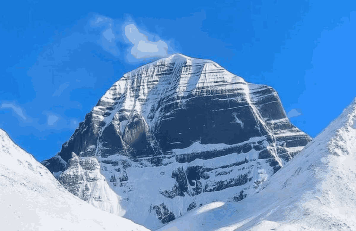
This short distance contains within it one of the most arresting moments of the entire yatra: the
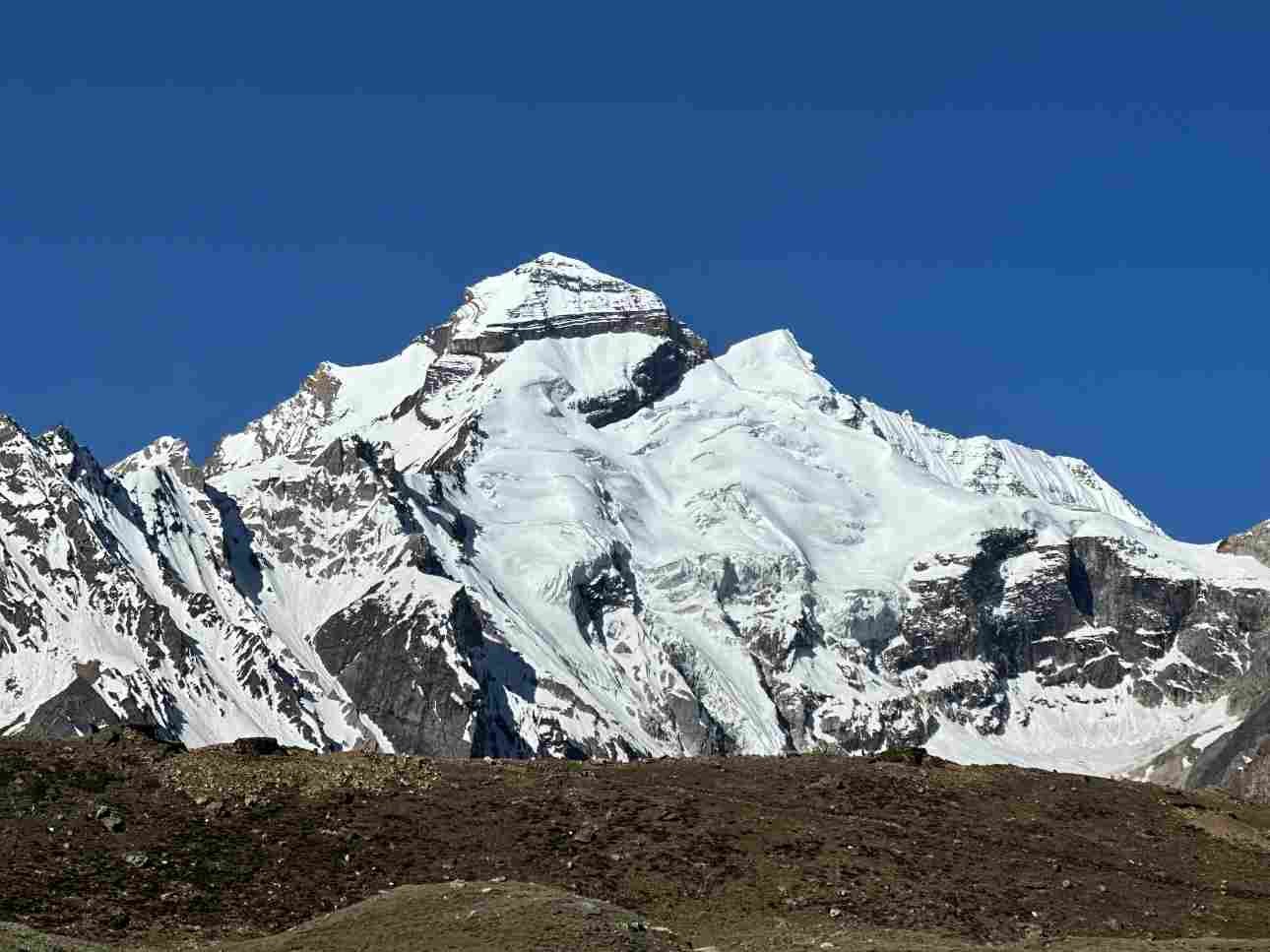
first clear sighting of Mount Kailash as you drive north from the lake. The mountain appears on
the horizon and then grows — its four symmetrical faces, the vertical cleft on the south face
that creates a natural swastika in certain light, the permanent snow cap — and the distance
between the lake and the mountain makes sudden, physical sense as a sacred geography
rather than just a map measurement.
The Distance Between Mount Kailash and Mansarovar
The distance between mount kailash and mansarovar — measured as a straight line between
the summit of the mountain and the northern shore of the lake — is approximately 30 km. In the
Hindu cosmological framework, these two features are inseparable: the mountain as the divine
abode of Shiva, the lake as the celestial reservoir created by Lord Brahma. The physical
distance between them is, in this framing, a measure of the sacred geography of the universe.
The distance between kailash and mansarovar as experienced on the ground — that drive
north from the lakeside guesthouses to the guesthouses at Darchen — is one of the moments
that most pilgrims describe as a shift in emotional register. The lake has been gentle, reflective,
deeply still. The mountain is different. It is present in a way that the lake is not. The closer you
get, the more it fills your field of vision and, according to almost everyone who has made this
approach, something else besides.
Darchen to Mount Kailash Distance and the Start of the Kora
Darchen is not at the base of Mount Kailash itself — it is the nearest settled point to the
mountain, from which the Kora begins. The darchen to mount kailash distance — meaning the
distance from Darchen to the closest face of the mountain — is approximately 3 to 5 km as the
crow flies, though the terrain means you are always walking a route around the mountain rather
than directly toward it.
From Darchen, the Kora begins heading west along the Lha Chu river valley. The first day of
the Kora takes pilgrims along the western and then northern face of the mountain — a full day's
walking of approximately 20 km — to the camp at Dirapuk, which sits directly beneath the
dramatic north face of Mount Kailash.
Darchen to Dirapuk Distance: The First Day of the Kora
The darchen to dirapuk distance is approximately 10 to 12 km of walking on the first day of the
Kora. This sounds modest — and in distance terms it is — but it involves a steady altitude gain
from Darchen at 4,575 m to Dirapuk at approximately 5,000 m, across terrain that ranges from
wide river valley paths to rocky hillside tracks.
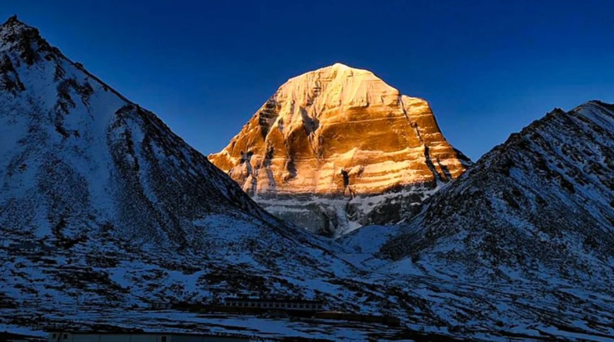
Dirapuk is where most pilgrims spend the first night of the Kora. The camp sits in a shallow
valley with an almost unreasonably direct view of the north face of Mount Kailash — a wall of
dark rock and permanent snow that fills the entire skyline to the south. Many pilgrims describe
this first view of the north face from Dirapuk as the single most powerful visual experience of
their lives.
| Segment | Distance | Start Altitude | End Altitude |
| Darchen → Dirapuk (Day 1) | ~10–12 km | 4575 m | ~5000 m |
| Dirapuk → Zutulpuk (Day 2) | ~22 km | 5000 m | 5630 m (pass) → ~4790 m |
| Zutulpuk → Darchen (Day 3) | ~18–20 km | ~4790 m | 4575 m |
| Total Kora | — | — | — |
Mansarovar to Darchen: Understanding the Full Sacred
Circuit
The mansarovar to darchen leg is the bridge between the two sacred sites at the heart of the
pilgrimage. Most kailash mansarovar package itineraries spend two nights at Mansarovar —
one for the sunset over the lake and the early morning bathing ritual, one for the optional partial
circumambulation of the lake — before making the 30 to 35 km drive north to Darchen to begin
the Kora.
This transition from lake to mountain is, for many pilgrims, an emotional as much as a physical
journey. Mansarovar is a place of stillness and reflection — the blue water at 4,590 m, the sky
that seems closer than anywhere else on Earth, the reflected image of Kailash on a clear
morning. Darchen is a place of preparation and purpose — a functional village at the start of
one of the most demanding walks in the world.
Do not rush the mansarovar to darchen leg. The 30 to 35 km is easily covered in under an hour
by vehicle. But most experienced operators build in time at the Chiu Gompa monastery — a
tiny cliff-top monastery visible from the western end of Mansarovar — and at the point where
the road offers the clearest view of both the lake and the mountain simultaneously. This view —
Kailash rising above the northern horizon, Mansarovar spreading to the south — is one of the
defining images of the entire yatra.
Kathmandu to Kailash Mansarovar Distance: The Nepal Route
For pilgrims coming via the Nepal route — the most popular route for international travellers
and increasingly popular for Indian pilgrims seeking an alternative to the MEA quota system —
the kathmandu to kailash mansarovar distance is approximately 1,000 to 1,200 km in total,
combining flights within Nepal with road travel through Tibet.
Kathmandu Route Distance Breakdown
| Segment | Mode | Distance / Time |
| Kathmandu → Simikot | Flight | ~45 min (~370 km) |
| Simikot → Hilsa | Flight / Trek | ~50 km |
| Hilsa → Taklakot (Purang) | Road | ~10 km |
| Taklakot → Lake Mansarovar | Road | ~100 km |
| Mansarovar → Darchen | Road | ~30–35 km |
| Total (Kathmandu → Mansarovar) | Combined | ~1000–1200 km |
The Nepal route is considered more accessible than the Uttarakhand route because it involves
significantly less overland trekking. The flights from Kathmandu to Simikot and Simikot to Hilsa
are small mountain aircraft operations that can be affected by weather — delays of one to two
days at these airstrips are not uncommon and any good kailash mansarovar yatra package
built on the Nepal route will have buffer days built in precisely for this.
Uttarakhand to Kailash Mansarovar Distance: The India Route
The uttarakhand to kailash mansarovar distance — measured from Dehradun, the most
common starting point for the Indian government-managed yatra — is approximately 850 to
900 km by road. This route crosses the Lipulekh Pass at 5,334 m into Tibet and then continues
through the Tibetan plateau to Taklakot (Purang) and onwards to Mansarovar and Darchen.
Uttarakhand Route Distance Breakdown
| Segment | Distance | Notes |
| Dehradun → Dharchula | ~450 km | Road (2 days) |
| Dharchula → Gunji / Nabhidhang | ~90 km | Road + trek sections |
| Nabhidhang → Lipulekh Pass | ~12 km | Trek; highest point (5334 m) |
| Lipulekh → Taklakot (Purang) | ~65 km | Road (Tibet) |
| Taklakot → Mansarovar | ~100 km | Road |
| Total (Dehradun → Mansarovar) | ~850–900 km | 22–28 days journey |
Indian nationals travelling the Uttarakhand route must obtain a slot through the Ministry of
External Affairs (MEA) quota system, which allocates a limited number of places each year.
Applications open typically in February or March for the May–September season. The kailash
yatra package operators registered with the government handle the permit documentation, but
the MEA slot must be obtained first.
Mansarovar Distance from My Location: How to Calculate
Your Route
If you are searching for mansarovar distance from my location, the practical answer is that the
final approach to Lake Mansarovar is always through either Nepal (via Simikot–Hilsa–Taklakot)
or India (via Uttarakhand's Lipulekh Pass). There is no third major entry route currently
available for Indian or international pilgrims.
As a general guide:
- Delhi to Mansarovar (via Uttarakhand route): ~1,100 km total distance, 22 to 28 days
- Mumbai to Mansarovar (fly to Delhi, then Uttarakhand route): ~1,300 km+ total, same
duration
- Bengaluru to Mansarovar (fly to Kathmandu, then Nepal route): ~1,800 km+ total, 14 to
21 days
- Kathmandu to Mansarovar (Nepal route): ~1,000 to 1,200 km combined, 14 to 21 days
- Lhasa to Mansarovar (overland Tibet, for those entering via Lhasa): ~1,400 km, 3 to 4
driving days
The best approach is to contact a licensed kailash mansarovar yatra package operator who can
plan a complete itinerary from your nearest gateway city. The distances above are approximate
and the actual travel time depends heavily on acclimatisation stops, road conditions, weather,
and permit processing.
What These Distances Mean in Practice: Tips for Planning
Your Yatra

Raw distance numbers on a map of Tibet mean something different from the same numbers on
a highway anywhere else in the world. Here is what every pilgrim needs to understand about
the distances on this route.
- Altitude changes everything. A 200 km drive at 4,400 metres in a loaded vehicle on a
plateau road takes longer than you expect. Factor in altitude fatigue, the effect of thin air on
engine performance, and the tendency of high-altitude driving to be slower than sea-level
driving
- Acclimatisation stops are not optional delays. When your kailash mansarovar package
includes a night at Saga or Paryang, this is not padding in the itinerary. It is protecting you
from altitude sickness at Darchen and on the Kora. Do not try to compress these stops
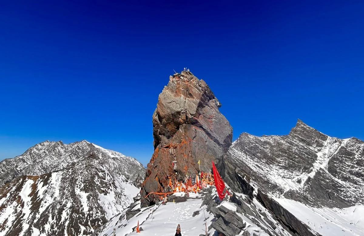
- The Kora distance is cumulative altitude, not just horizontal. The 52 km Kora includes
the climb to Dolma La at 5,630 m. At altitude, 12 km with 900 m of ascent takes significantly
longer and is significantly harder than 12 km at sea level. Plan accordingly.
- Road conditions vary by year and season. The G219 and the approaches to Mansarovar
and Darchen are improved and damaged every year. Your operator's local knowledge of
current conditions is more reliable than any fixed distance guide.
- Buffer days are the mark of a good package. Any kailash mansarovar yatra package
worth booking will have buffer days built in — for weather delays, permit delays, road
closures, and the simple reality that at altitude, bodies do not always move on schedule.
Complete Kailash Mansarovar Distance Reference Table
| Route Segment | Distance | Time |
| Saga → Mansarovar | ~460–480 km | ~2 days |
| Saga → Darchen | ~390–410 km | 1–2 days |
| Paryang → Mansarovar | ~260–280 km | 5–6 hrs |
| Mansarovar → Darchen | ~30–35 km | 45–60 min |
| Kailash Kora (Full) | ~52 km | 3 days |
| Kathmandu → Mansarovar | ~1000–1200 km | 14–21 days |
| Dehradun → Mansarovar | ~850–900 km | 22–28 days |
| Taklakot → Mansarovar | ~100 km | ~2 hrs |
ConclusionThe saga to mansarovar distance is approximately 460 to 480 km by road. The saga to
darchen distance is approximately 390 to 410 km. The lake mansarovar to darchen distance is
30 to 35 km. The darchen to dirapuk distance is 10 to 12 km on foot. And the Kora around
Mount Kailash is 52 km walked over three days at altitudes between 4,575 and 5,630 metres.
These are the numbers. They are useful, and this guide has laid them out as clearly as
possible. But every pilgrim who has completed this journey will tell you the same thing: the
distances on a map bear almost no relationship to what those distances feel like on the ground.
A 10 km walk at 5,000 metres to Dirapuk, with the north face of Mount Kailash growing in front
of you and the thin air turning every step into a deliberate act — that is not 10 km. It is
something else entirely.
Plan the distances. Know the route. Book a well-supported kailash mansarovar yatra package
with a licensed, experienced operator. Prepare your body seriously. And then surrender to the
fact that once you are on this road — past Saga, crossing the plateau toward the lake and the
mountain — the distances stop mattering very much at all.